

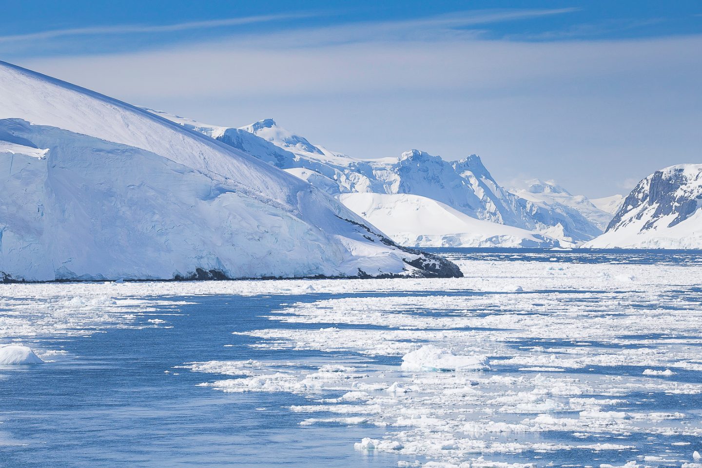
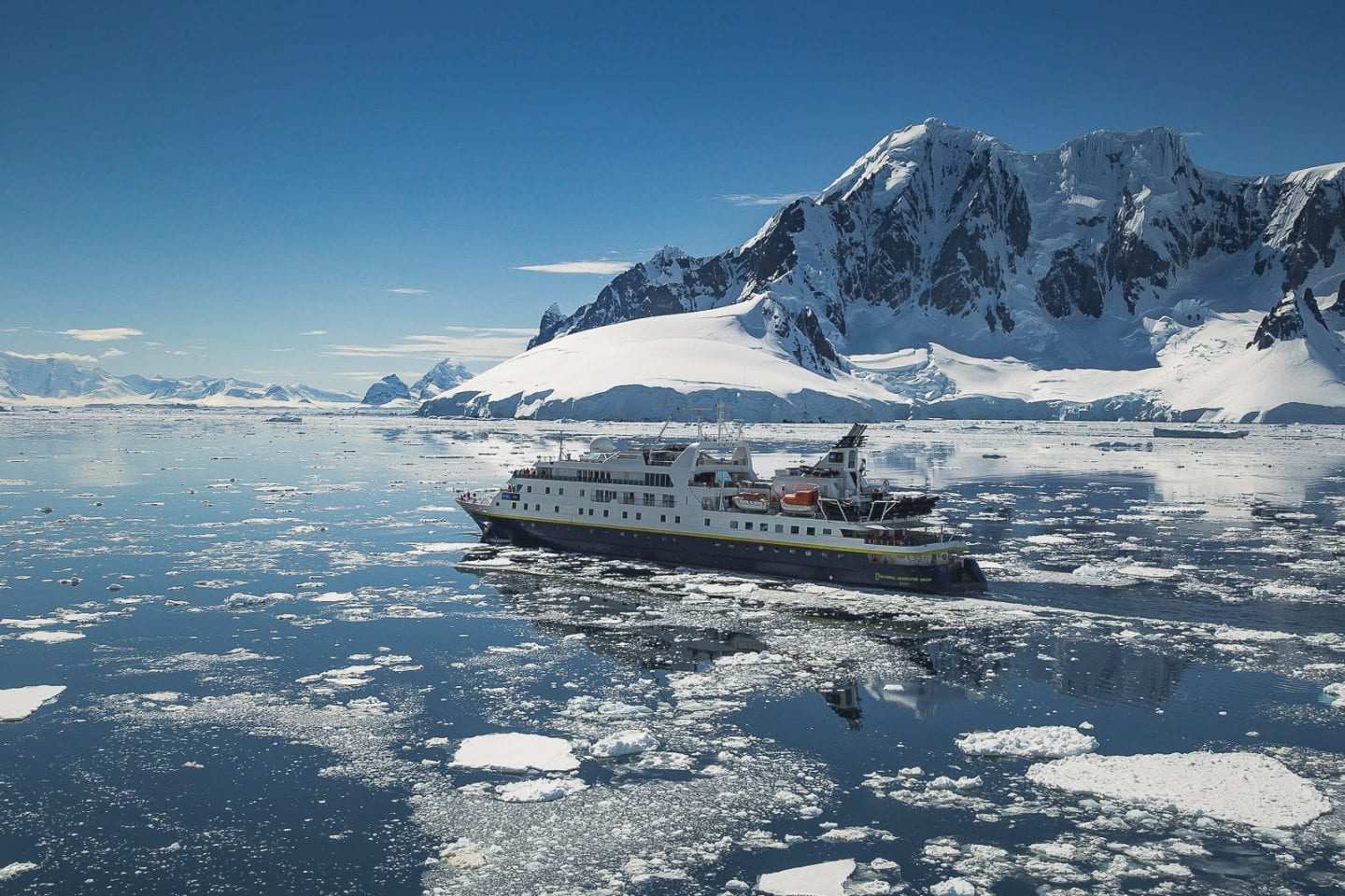
It was hard to believe after the beauty of Falkland Islands and the high of South Georgia, that the main attraction of our 22-day ultimate expedition was still yet to come - Antarctica. We had seen so much already - could Antarctica outdo the incredible wildlife and scenery of South Georgia? We weren't sure, but we had six whole days of Antarctic landing and cruising to find out.
Approaching Antarctica
Point Wild on Elephant Island
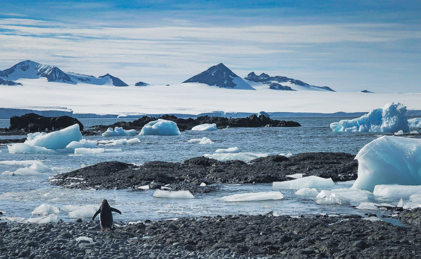
Similar to Cape Rosa in South Georgia, our first stop in Antarctica was a Shackleton one - the infamous Point Wild on Elephant Island. Over the two sea days it took us to get here from South Georgia, it was insane to think that Shackleton and co. sailed the reverse route in an open boat and somehow made it. Once we arrived, it was even crazier to imagine the rest of Shackleton's men being stuck here for more than four months waiting for the rescue that may never come, on the treacherous rocky shores of Point Wild. The rescue did miraculously come, and now a commemorative bust of the brave Chilean captain who sailed here for the risky rescue marks the spot.
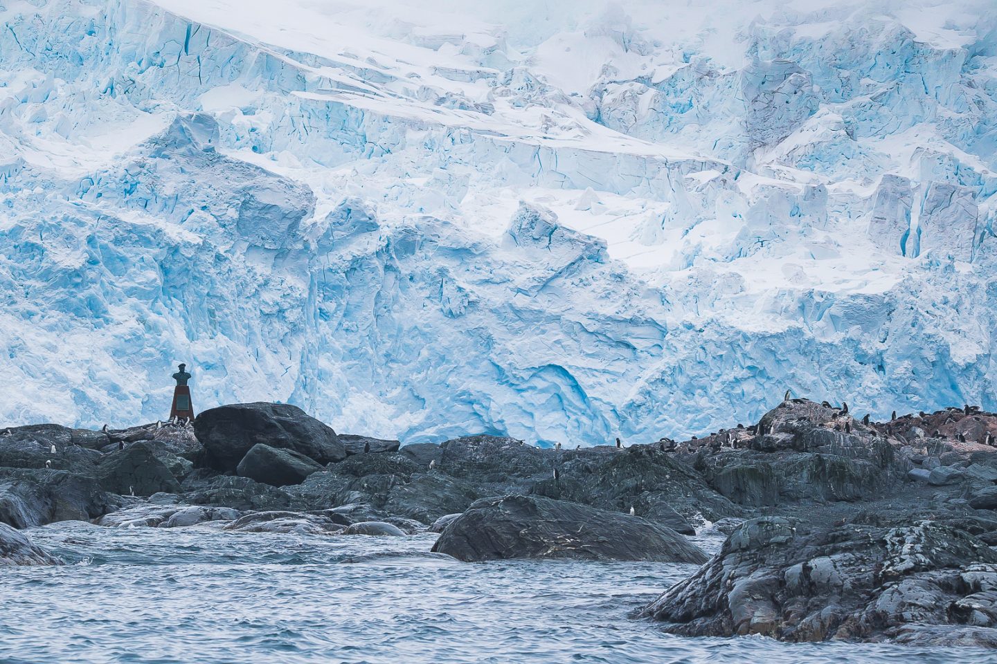
Bust of Chilean captain on Elephant Island, Antarctica
The thick fog set the scene. We were afraid we wouldn't be able to land at all, but the first few boat groups made it. Halfway through, however, all landings were aborted as ice chunks clogged the beach. We swallowed the bitter taste of disappointment having been so excited for our very first Antarctic landing. Argh! Thankfully cruising turned out to still be possible (woohoo!), so we took an explorer boat out to get closer to shore.
Leaving the Fram on a tender boat for a scenic cruise
Cruising in the explorer boat gave us a brand new perspective. The cold, rippling water was literally within reach as the boat crunched through the floating ice. Glaciers looked even more imposing than usual. Rocky cliffs seemed even steeper than we had thought. The swell relentlessly slapped against any obstacles in its way.
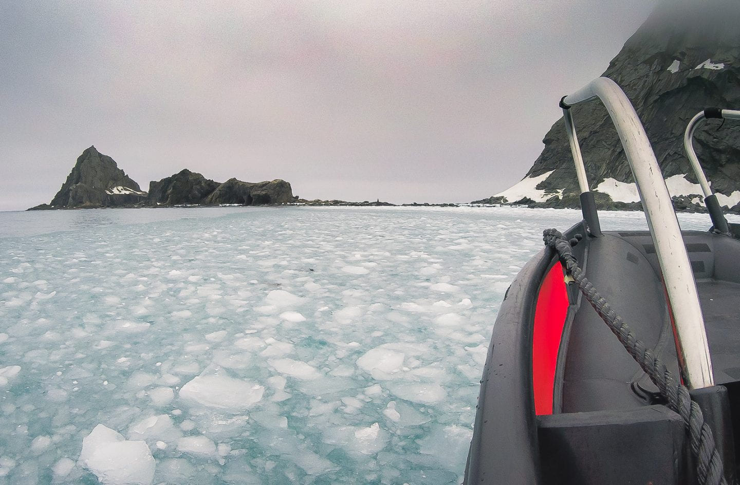
Tender boat going through ice covered water
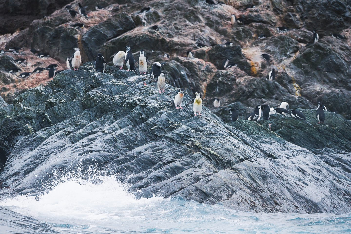
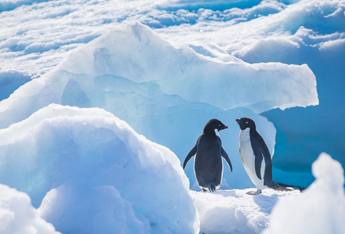
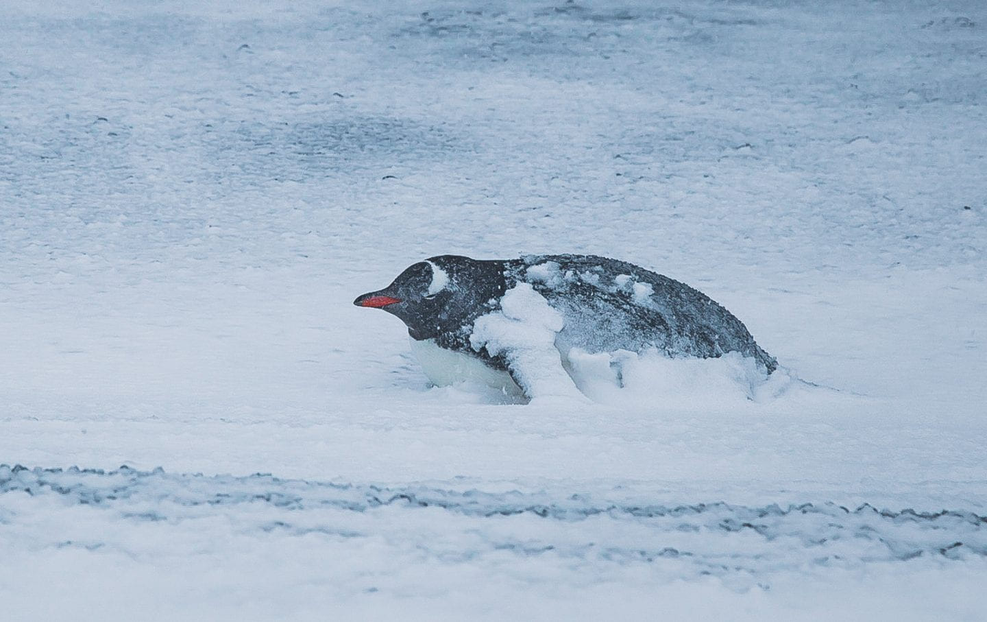
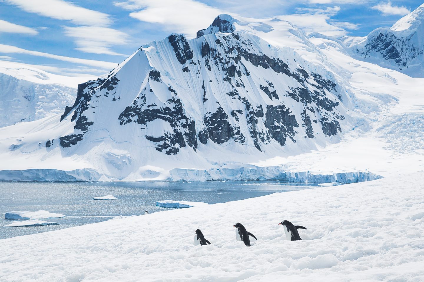
These conditions may not sound conducive to life, but a colony of hardy chinstrap penguins flourished. They were everywhere at Point Wild - nesting around the statue, perching on the rocky cliffs, feeding around the waters. Are penguins ever not cute?
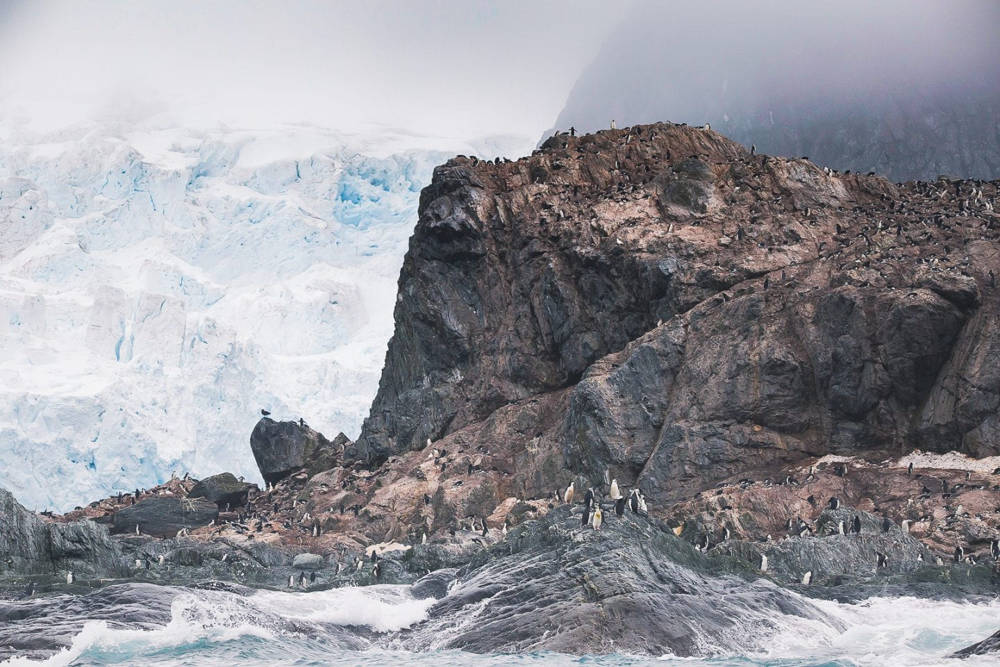
Chinstrap colony on the cliffs of Point Wild, Antarctica
Chinstrap penguins ready to jump into ice cold water
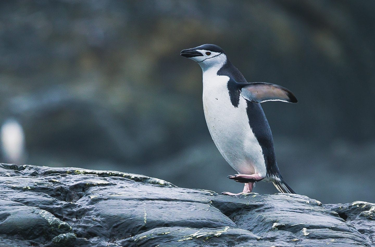
Chinstrap penguin
We left Point Wild exactly that - flushed and exhilarated and feeling more wild than ever. So ready for the rest of what Antarctica would bring.
Brown Bluff
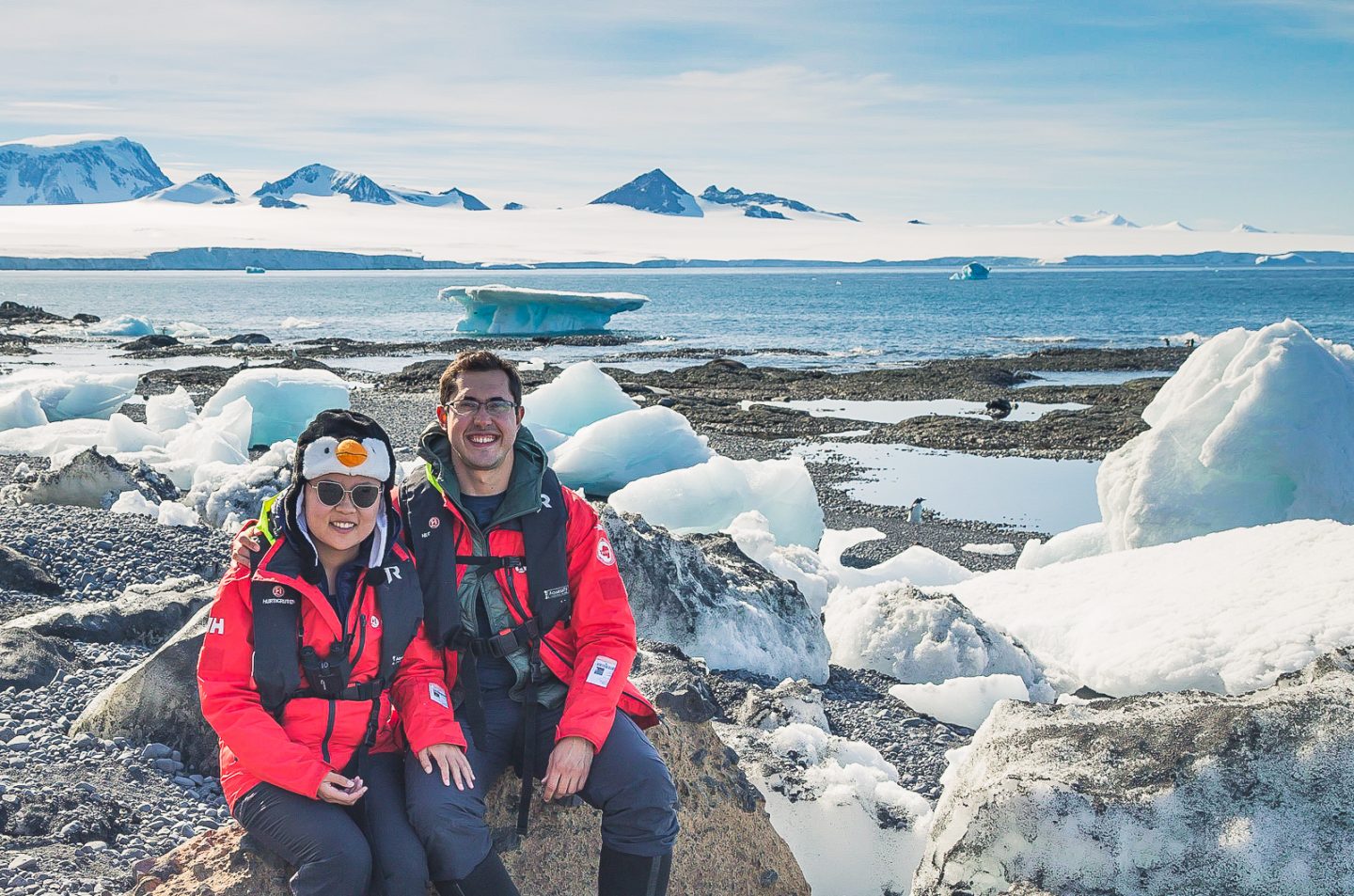
Brown Bluff was our first ever continental Antarctica landing; not just an island in Antarctica, but actually on the Antarctic Peninsula, where we could theoretically reach the South Pole on land if we walked far enough (crazy thought!). We stepped foot in Antarctica! And was it on a lovely day. The weather could not have been more perfect.
Brown Bluff landing site
As the name suggests, tall brown bluffs towered over the landing site, while floating ice dotted the shore. The idyllic Antarctic landscape of land and sea, brown and blue and pure white.
Idyllic landscape at Brown Bluff, Antarctica
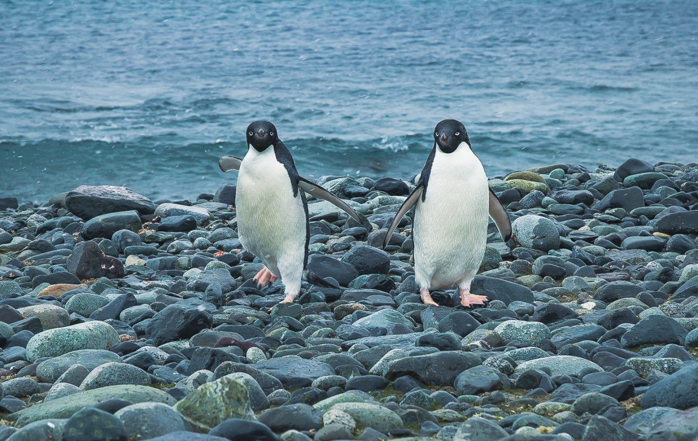
Of course, the picture would not be complete without penguins. Brown Bluff had the first and only colony of adelie penguins we encountered. The distinctive white circle around their eyes contrasted nicely with their black head and back.
Adelie penguins on ice, Brown Bluff, Antarctica
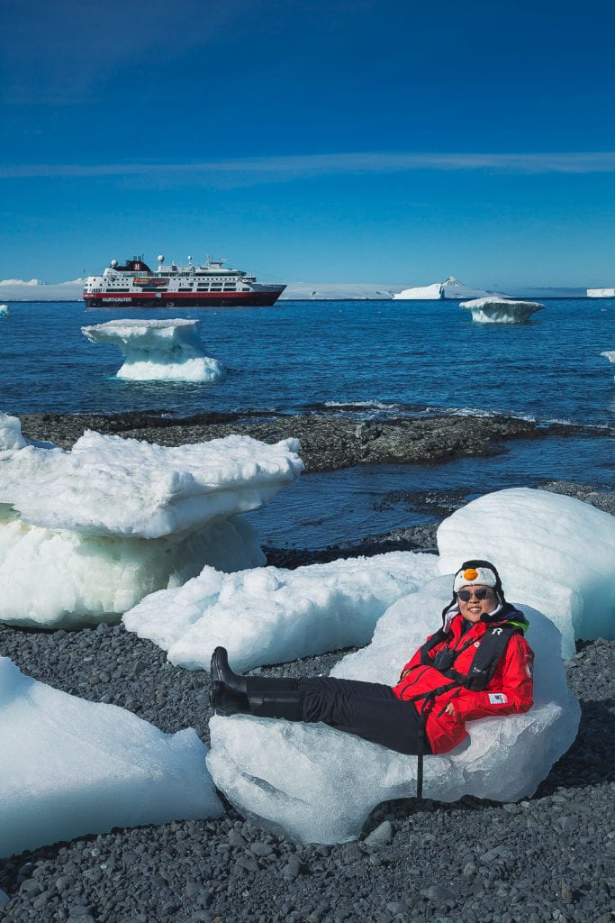
Time passed by way too fast; we could have stayed all day. There were even natural places to lounge! Admittedly a bit cold, but totally worth it.
Julie & Carlos at Brown Bluff, Antarctica
Julie lounging on a chunk of ice, Brown Bluff, Antarctica
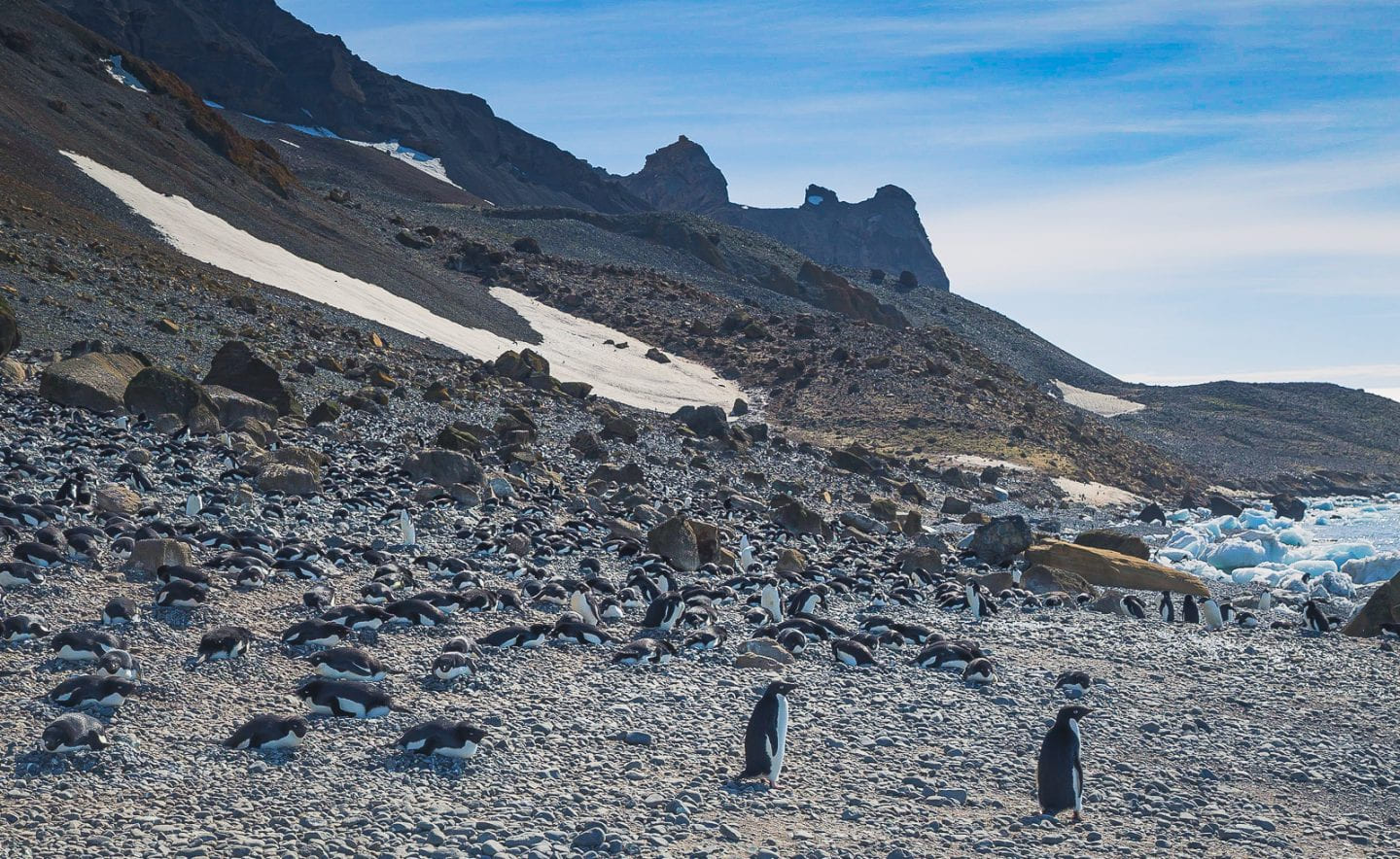
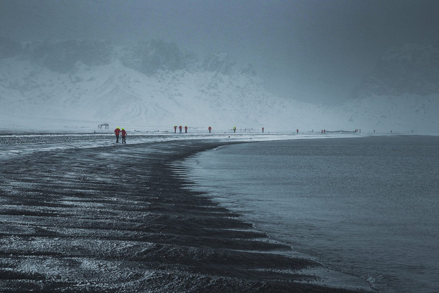
Yankee Harbor
Our third day in Antarctica made us feel the most alive. It began with snowy and windy conditions, the first we've had on the trip. Not that we would ever complain about good weather, but this was more like it for Antarctica!
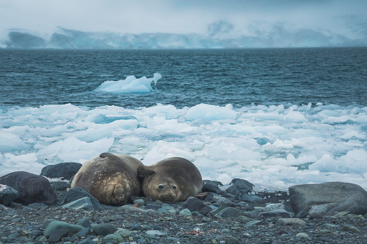
Weddell seals at Yankee Harbor, Antarctica
A long protected bay-shaped harbor, Yankee Harbor looked almost man-made. The sea was thus unusually calm, though it was windy the day we were there. We covered up more than any previous day against the wind and snow, though the air was undoubtedly fresh. Like we saw at Point Wild, that didn't bother the penguins at all, who were business as usual.
Adelie penguins on the rocky beach of Yankee Harbor, Antarctica
Little did we know we were about to very intimately feel the elements.
Deception Island and the Polar Plunge (!)
A last minute addition to the itinerary since we couldn't land in the Aitcho Islands, Deception Island is a caldera island accessible by ship. In true expedition style, this landing was not originally planned, but boy were we glad it happened. It was drama from beginning to end. Sailing through the narrow entrance to the caldera while it snowed upwards was quite a sight.
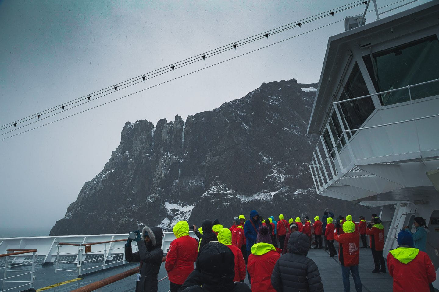
Explorers on deck for the narrow crossing, Deception Island
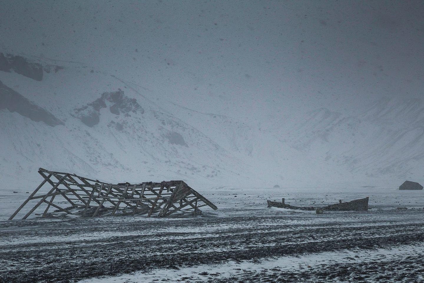
An abandoned whaling station can be found upon landing, but we chose to head the other way up towards Neptune's Window, a break in the caldera ridge. The wind continued to whip the snow sideways, making everything a blur of white and grey. The irony of this being an active volcano was not lost on us.
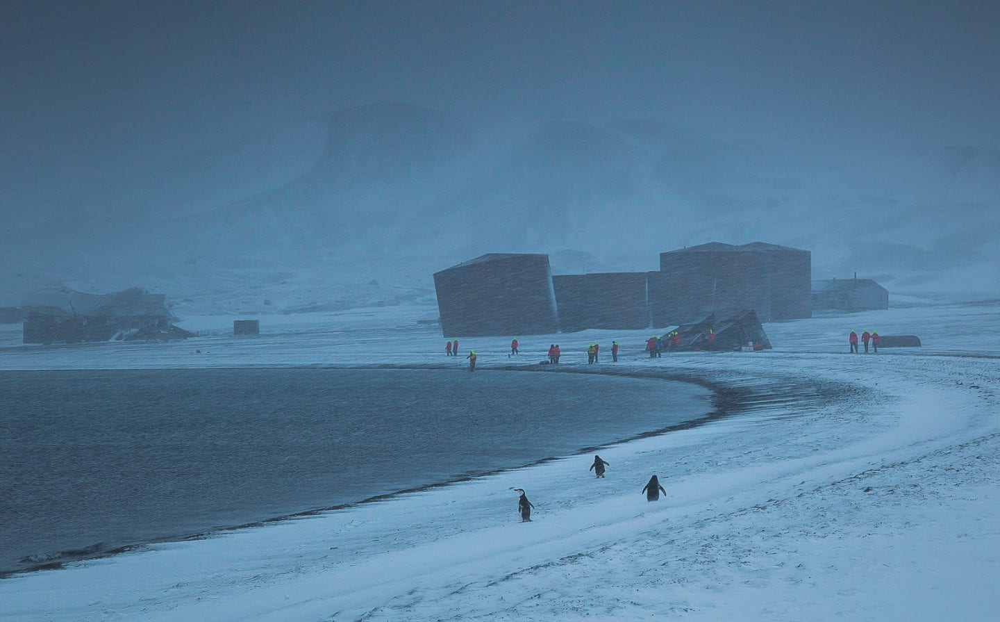
Abandoned whaling station, Deception Island
As usual, the penguins didn't mind. We passed by both gentoo and chinstrap penguins settled comfortably on their bellies as the snow gathered around them in a half nest half blanket.
Gentoo penguin with a snow blanket, Deception Island
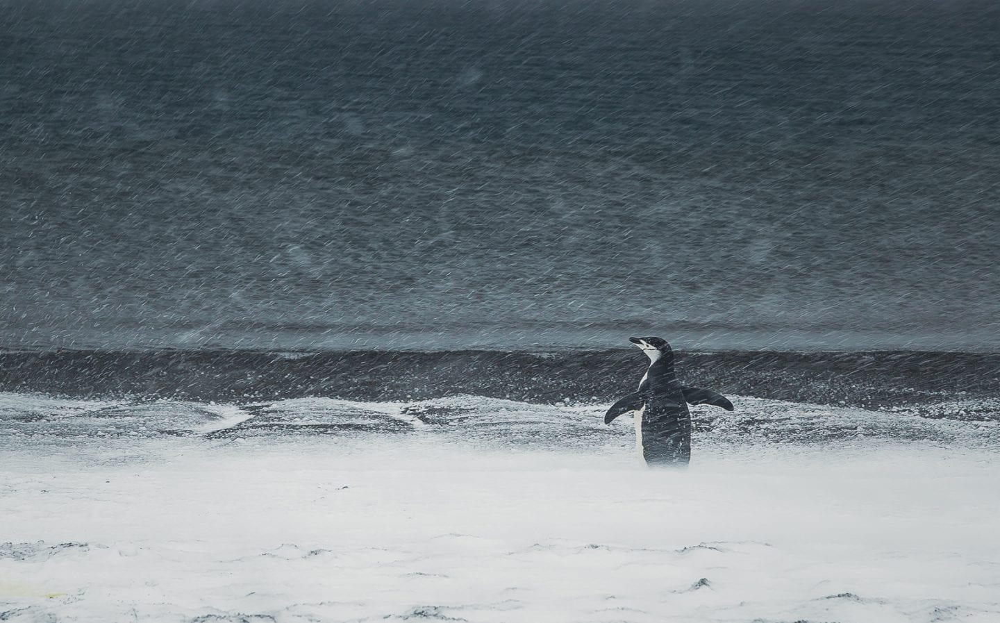
Chinstrap penguin playing in the snow, Deception Island
The view up at Neptune's Window was spectacular. Peering over the edge, we saw a straight drop down to the sea and what can only be described as a snow beach. Then the cliff rose sharply back up to a tall peak. Whoa! The blizzard conditions made it all that much more perilous.
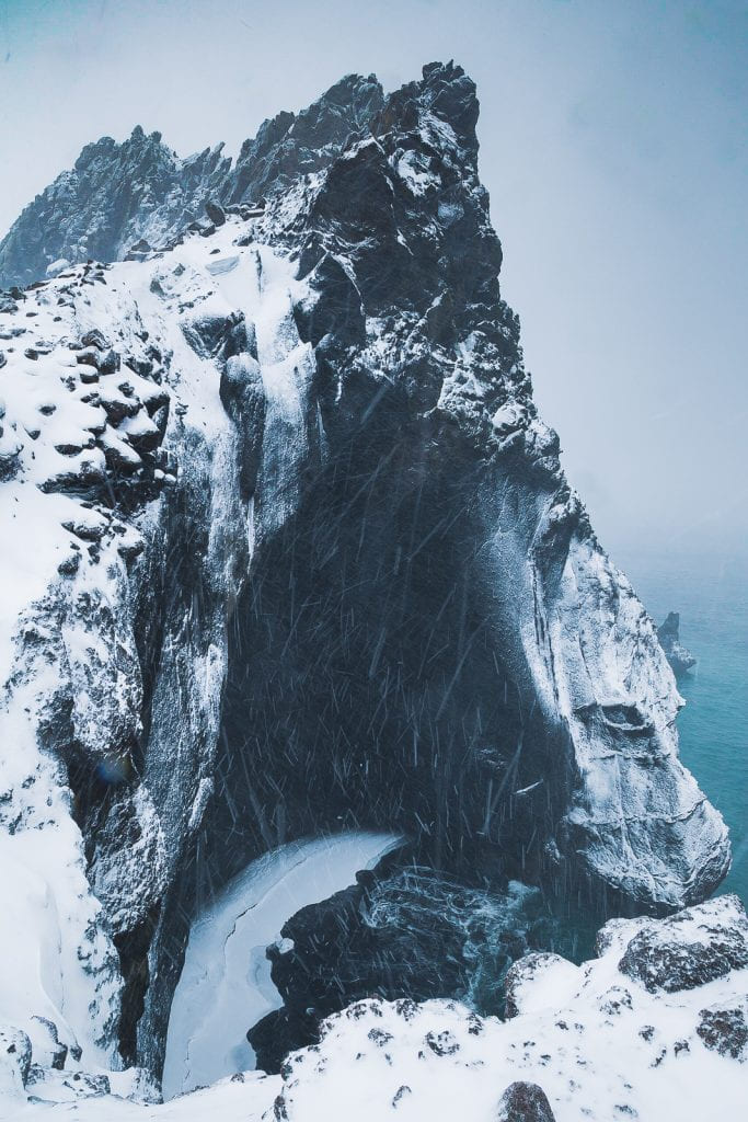
View from Neptune's window, Deception Island
Normally this would have been the climax of the landing, after which we headed back to the ship. Not at Deception Island. Here was also the site of the famous (and optional) polar plunge, saving the best for last. Carlos was sure he was going to take the plunge from the very beginning, but Julie was on the fence. Given the blizzard conditions, she was leaning towards no, but when it came time, she couldn't pass this once-in-a-lifetime opportunity.
Where the polar plunge happened, Deception Island
Taking off all of our warm clothes wasn't so bad. Jogging down the rocky beach towards the water in the blizzard in nothing but swimwear was bearable. Once we entered the water, however, it was another story. It was COLD. The water temperature was a little less than 2 degrees Celsius (~35 degrees Fahrenheit), which we quickly started feeling in our outer extremities. Julie went as far as submerging her waist before deciding she probably shouldn't go any further. She looked back to see Carlos bravely diving in head first (with glasses on!). This turned out to be a bad idea - in an involuntary gasp of cold underwater, he drank some really cold, really salty water (heh). We quickly huddled for a GoPro selfie.
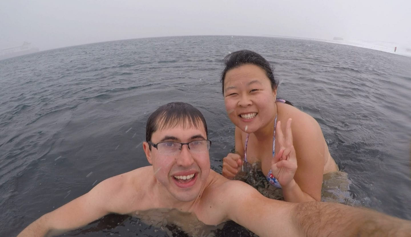
Selfie in ice cold water, Deception Island
Then we immediately started heading back to shore. By then our underwater body parts started feeling numb. We couldn't feel our feet. The blizzard continued above water. Time slowed down and the distance to shore stretched further. We started to panic. Only the surge of adrenaline kept us putting one foot in front of the other.
The blizzard continued, Deception Island
Fully emerging from the cold water was the worst of all, because then we felt the full force of the blizzard on our already cold and wet bodies. The wind speed that day was 55km/h (34mph). We barely held the towels handed out to us by the doctors supervising the polar plunge, our minds too consumed with the cold. Our bodies were probably in shock and it was hard to think straight. We had prepared clean clothes to change into afterwards, planned to hold towels around each other and where to store the wet clothes. It's ridiculously laughable in hindsight because all of that went out the window. We put our jackets and pants directly on our wet swimwear, and stuffed our bare feet directly into the muck boots, not bothering with socks or any inner layers. Then onto the next available tender boat back to the ship and immediately into a warm shower.
Waiting for the next tender boat, Deception Island
We were grateful beyond words to be warm again. To feel our feet again. To be alive. It was one of those life experiences that puts everything into perspective. All of those first world problems we worried about? None of those mattered as long as we had all of our toes. All of the self-doubts we had about our capabilities? Look at what we had survived. Deception Island will stay with us for life.
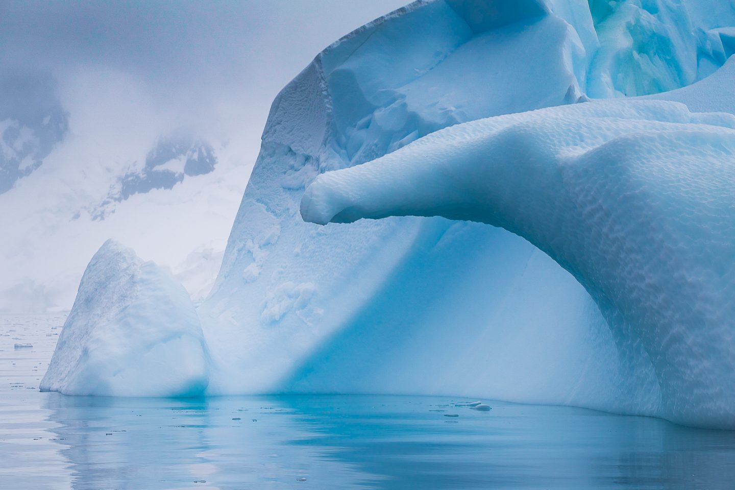
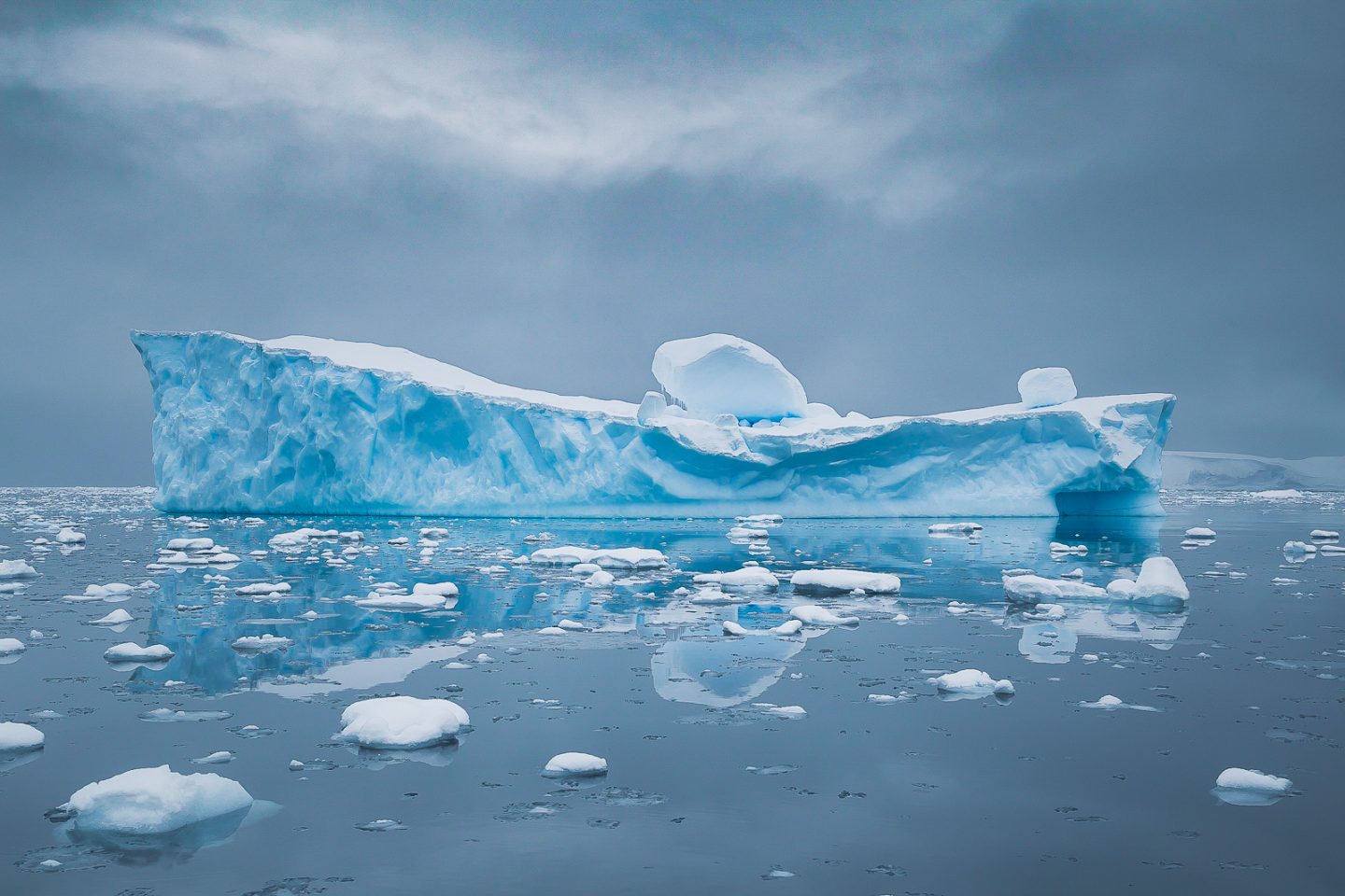
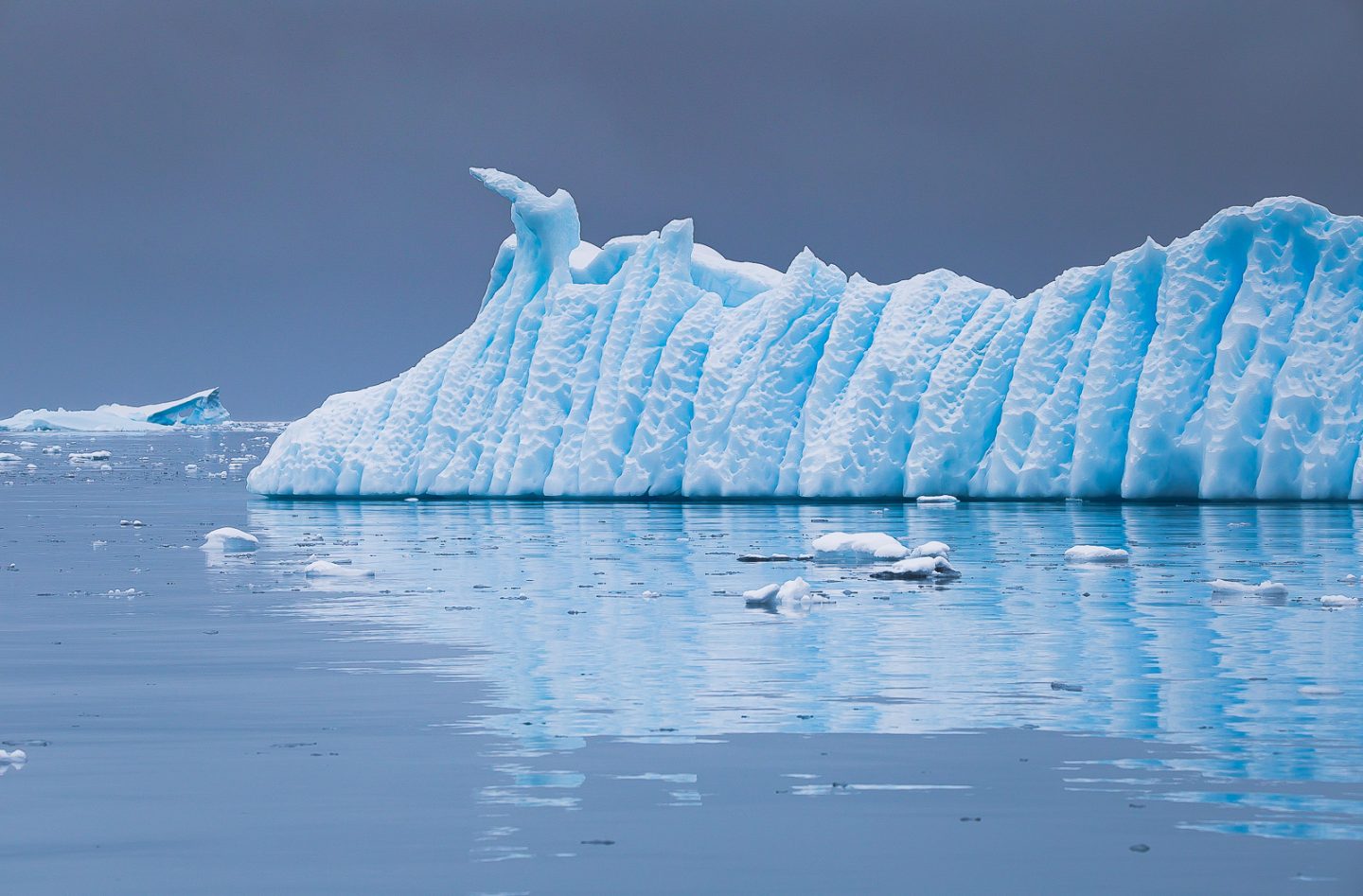
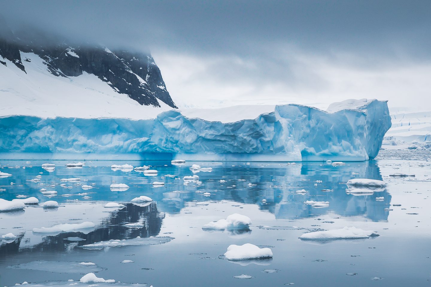
Wilhelmina Bay
Compared to the ups and downs of the previous day, Wilhelmina Bay was the total opposite. Cool, calm, and tranquil, Wilhelmina Bay felt like nature's art gallery, inviting us for a look around at all of its masterpieces.
Iceberg reflections, Wilhelmina Bay, Antarctica
Iceberg in Wilhelmina Bay, Antarctica
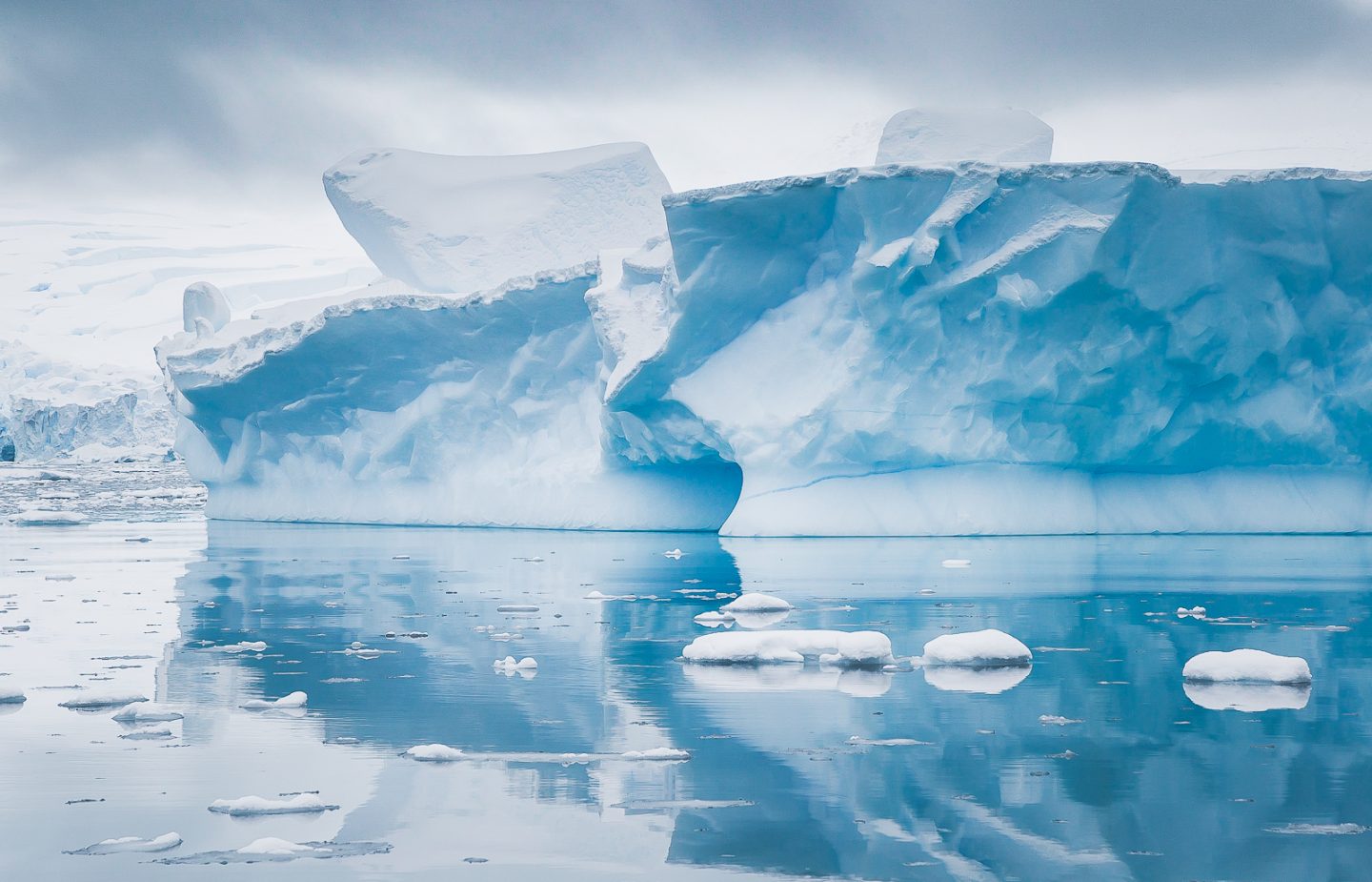
It was a dream scenic cruise. Less like a boat motoring through water, more like individual seats gliding through the mirror-like surface of another dimension. Ice formations of all shapes and sizes passed by, blue and white at the same time. Each new one somehow surpassing the previous in both intricacy and grandeur. Otherworldly.
Cruising at Wilhelmina Bay, Antarctica
Natural wonder, Wilhelmina Bay, Antarctica
Iceberg sculpted by air and water, Wilhelmina Bay, Antarctica
Glaciers and mountains and icebergs reflected themselves in the background, seemingly too perfect to be real. We even spotted a Weddell seal, sleeping on a floating piece of ice! If it was physically possible to not blink, we wouldn't have for fear of missing a single moment.
Mountain, glacier and iceberg reflected, Wilhelmina Bay, Antarctica
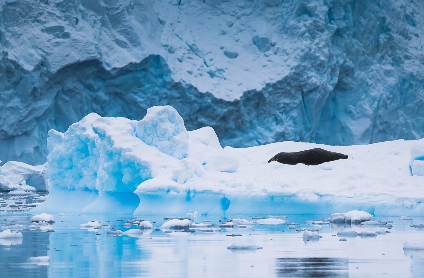
Weddell seal sleeping on ice, Wilhelmina Bay, Antarctica
How each new landing manages to unseat the previous one as our favorite every time was beyond comprehension.
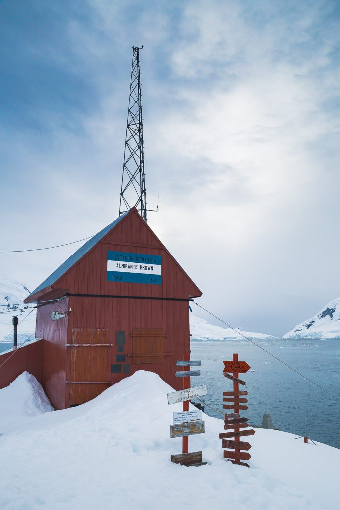
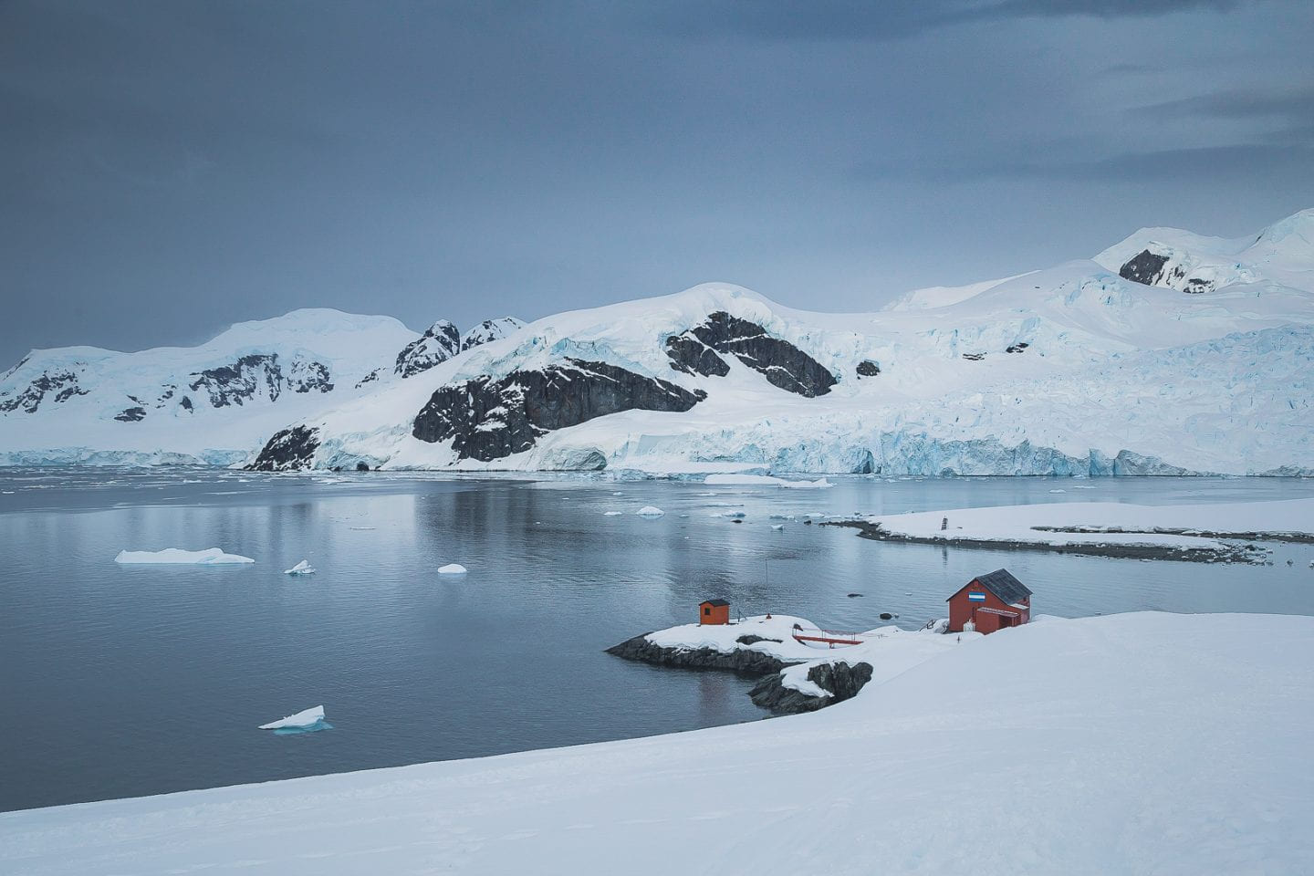
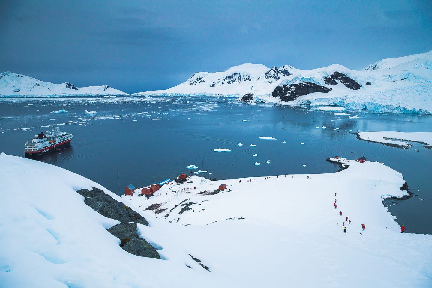
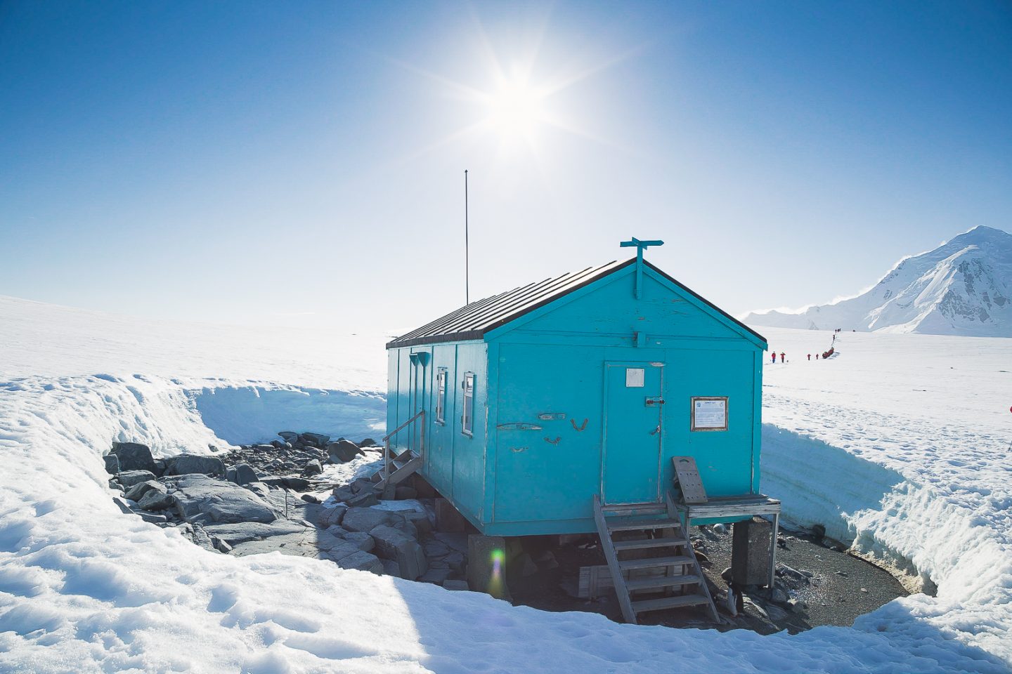
Almirante Brown Station in Paradise Harbor
Yet another last minute addition, our wish to visit an Antarctic station came true at Almirante Brown Station in Paradise Harbor. We're sure Orne Harbor would have been nice, but it couldn't have been as fun as our night in Brown Station.
Base Brown in Paradise Bay, Antarctica
An Argentinian base in continental Antarctica, Station Brown is only temporarily inhabited, so there were no humans to visit, only gentoo penguins. Perched at the bottom of a hillside overlooking Paradise Harbor, the houses were basic, but location, location, location. Paradise Harbor was as it sounds - so easy on the eyes.
Climbing the hill next to Base Brown, Paradise Bay, Antarctica
Since there was no one at the station, we could do whatever we wanted - just kidding! That's not true, though it certainly had that feeling. A snowy hike to the adjacent hilltop awarded us with incredible views of the whole harbor. Maybe it wouldn't be so bad to live here after all.
Overlooking Paradise Harbor, Antarctica
The best part of all was the way down. Normally we take the same trail back to minimize impact on the landscape, but this time we were given another option to slide down the hill on our bums. Guess what we chose? Our inner children came out and we gleefully slid down, hands in the air, grinning from ear to ear. Glissading in Antarctica - check!
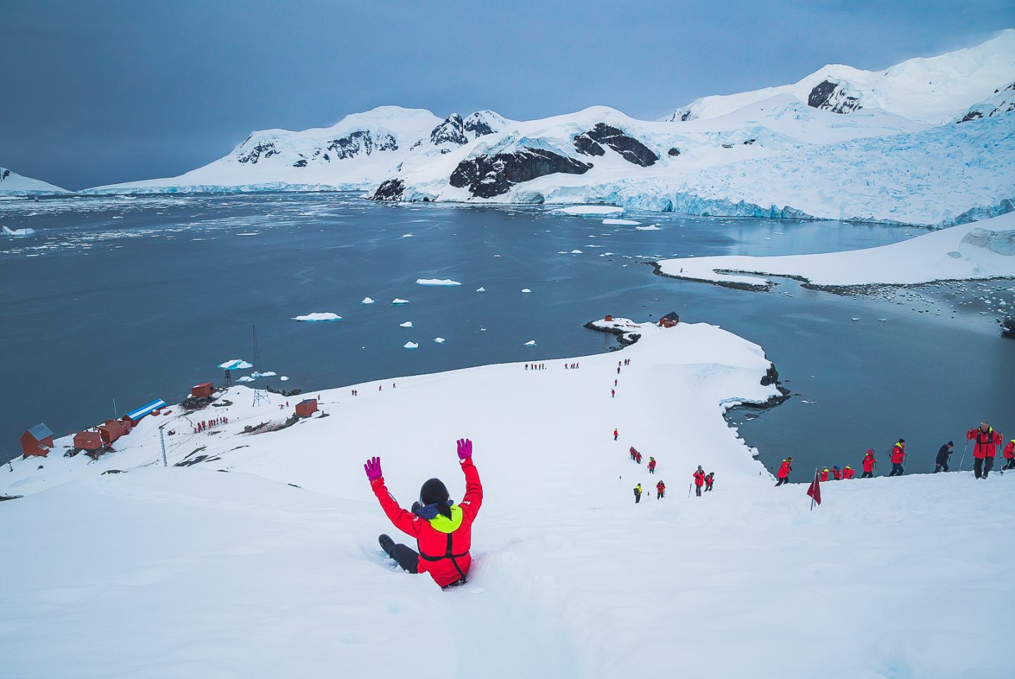
Glissading down the hill at Base Brown, Antarctica
Danco Island
The sun returned full force on our fifth day in Antarctica, just in time for the panoramic views on Danco Island. We had passed by the day before and watched another expedition ship land, slightly envious, so we were glad to be able to come back and experience for ourselves.
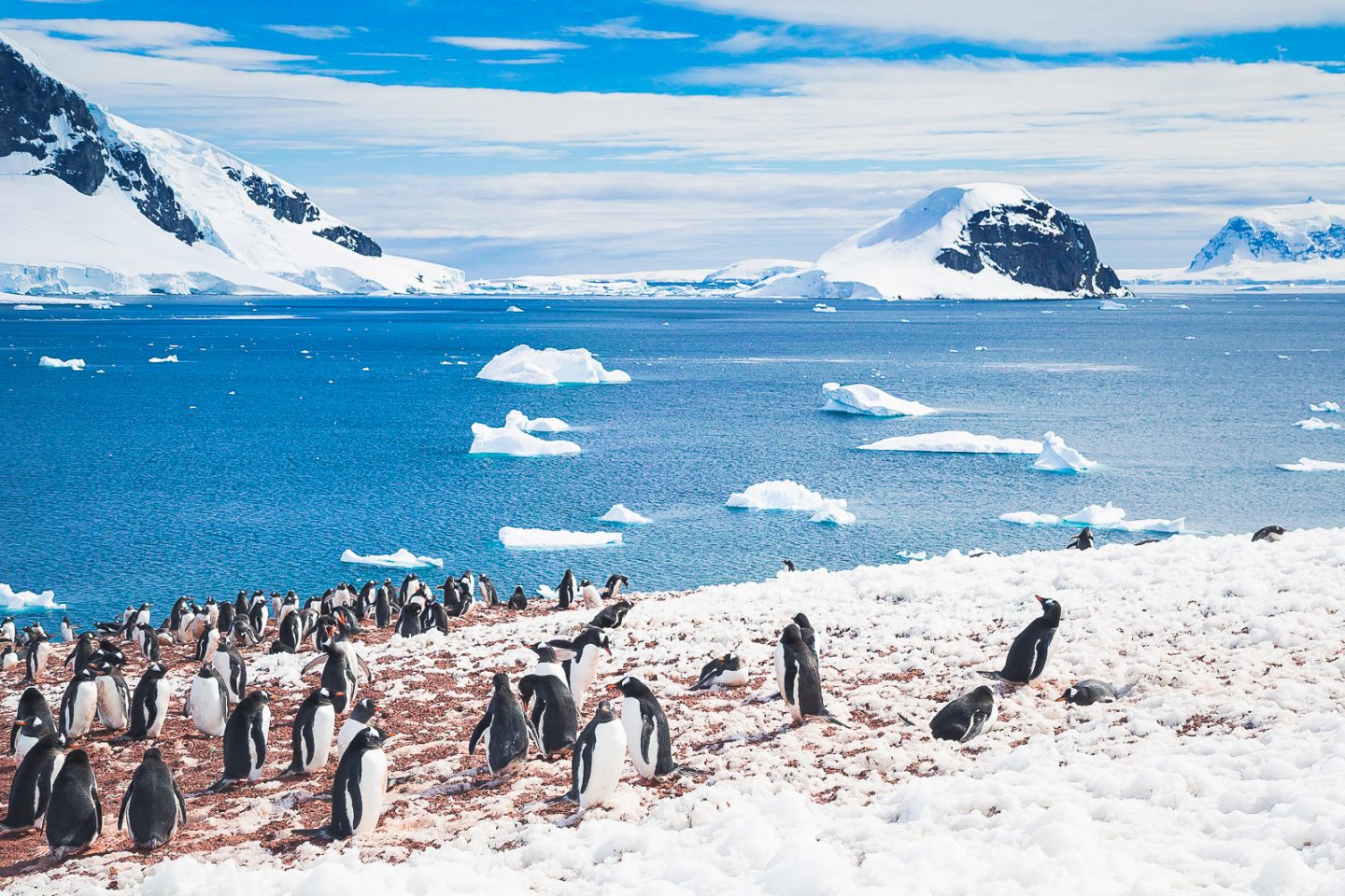
Gentoo penguin rookery on Danco Island, Antarctica
The snowy hike up to the top of the island was not as steep as the one at Brown Station, though longer. Along the way were long penguin highways we made sure to respect. So cool to see these in person!
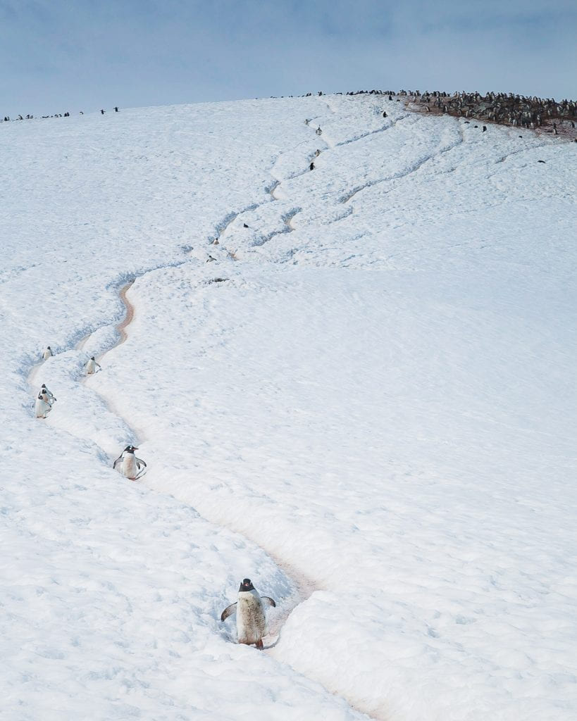
Penguin highway, Danco Island, Antarctica
Penguins using the highway, Danco Island, Antarctica
When we arrived, it felt like not just the top of Danco Island, but the top of the world. 360 degrees of pure Antarctica. The pictures will have to do when the words don't do justice.
Julie at the top of Danco Island, Antarctica
Everywhere we turned - untouched nature at its best.
View from the top of Danco Island, Antarctica
Even the MS Fram looked like it was exactly where it belonged.
MS Fram at Danco Island, Antarctica
It was really hard to say goodbye.
Leaving Danco Island behind
Damoy Point
Previously used as an airfield to supply nearby UK operations in Antarctica, the only evidence of any human settlement currently remaining at Damoy Point was a small hut... taken over by (who else?) penguins.
Hut at Damoy landing site, Antarctica
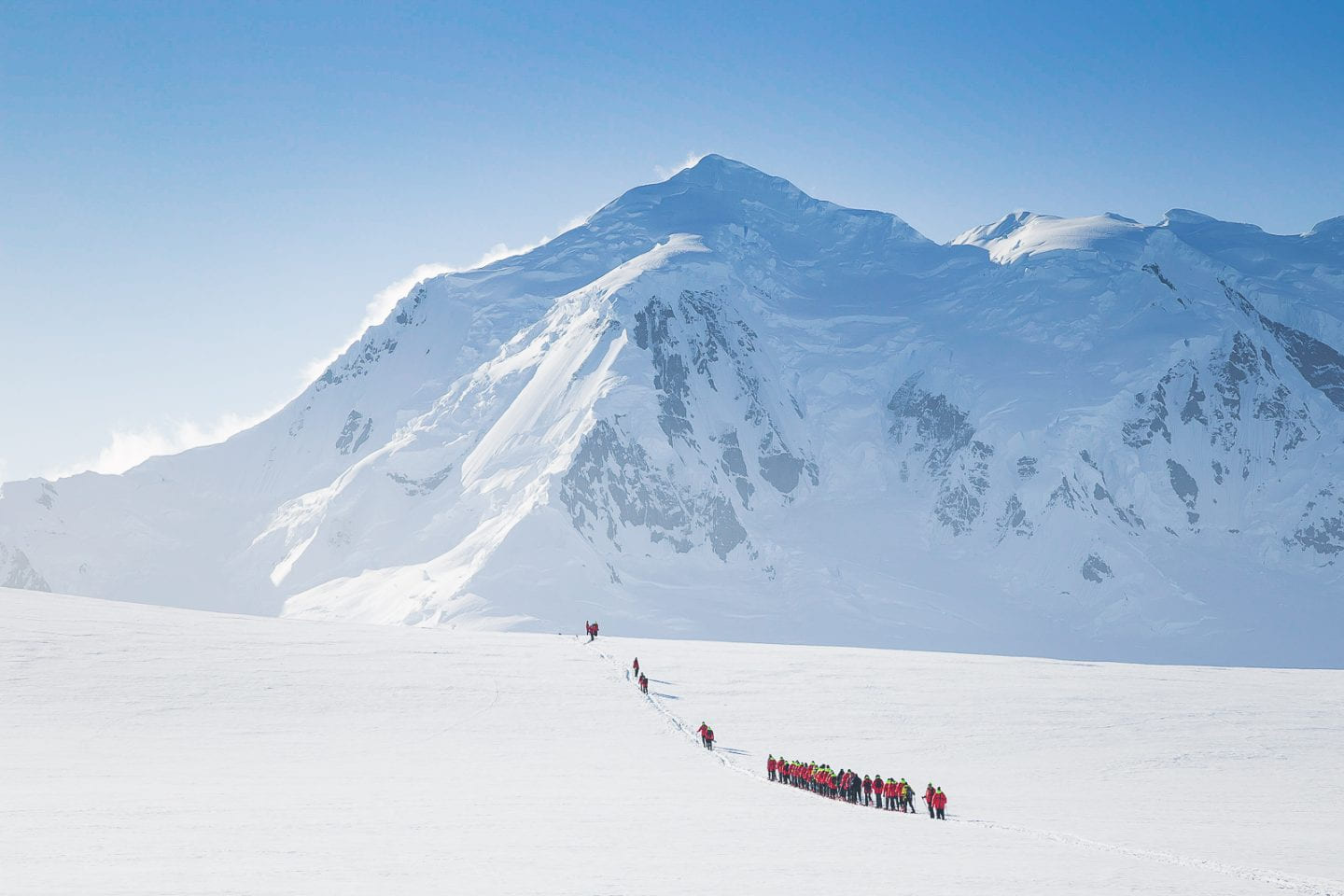
By this point, we had really learned to enjoy the hikes on snow, and really savored what was to be our last landing onshore. There was something magical about making your way through the endless white, realizing just how insignificant you are in the wilderness all around you. It felt like freedom.
Hiking to Port Lockroy, Antarctica
From a hilltop viewpoint at Damoy, it was possible to see Port Lockroy from afar. We didn't make a stop there as the station had just recently opened for the season due to ice conditions, but it is known for the most southerly operational post office in the world (shoutout to UK post office).
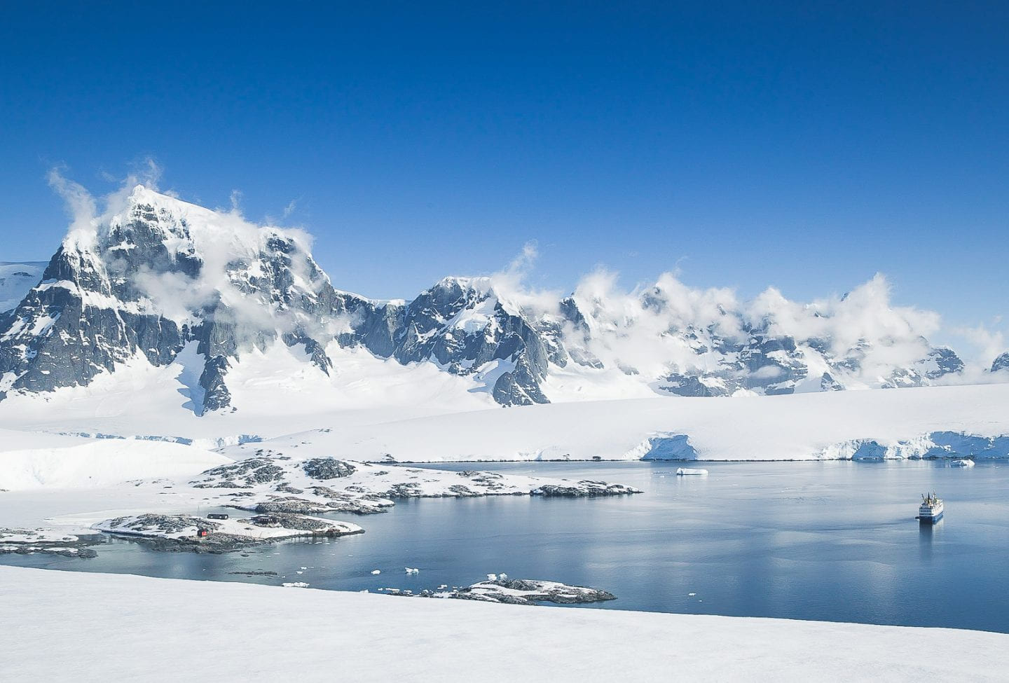
Overlooking Port Lockroy, Antarctica
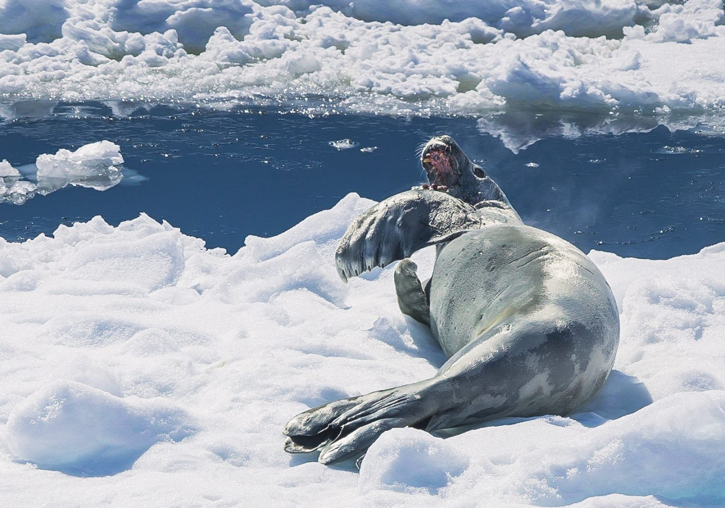
On the way back, we caught both Weddell seals and crab eater seals by the harbor. With some patience and luck, one of them even yawned for us!
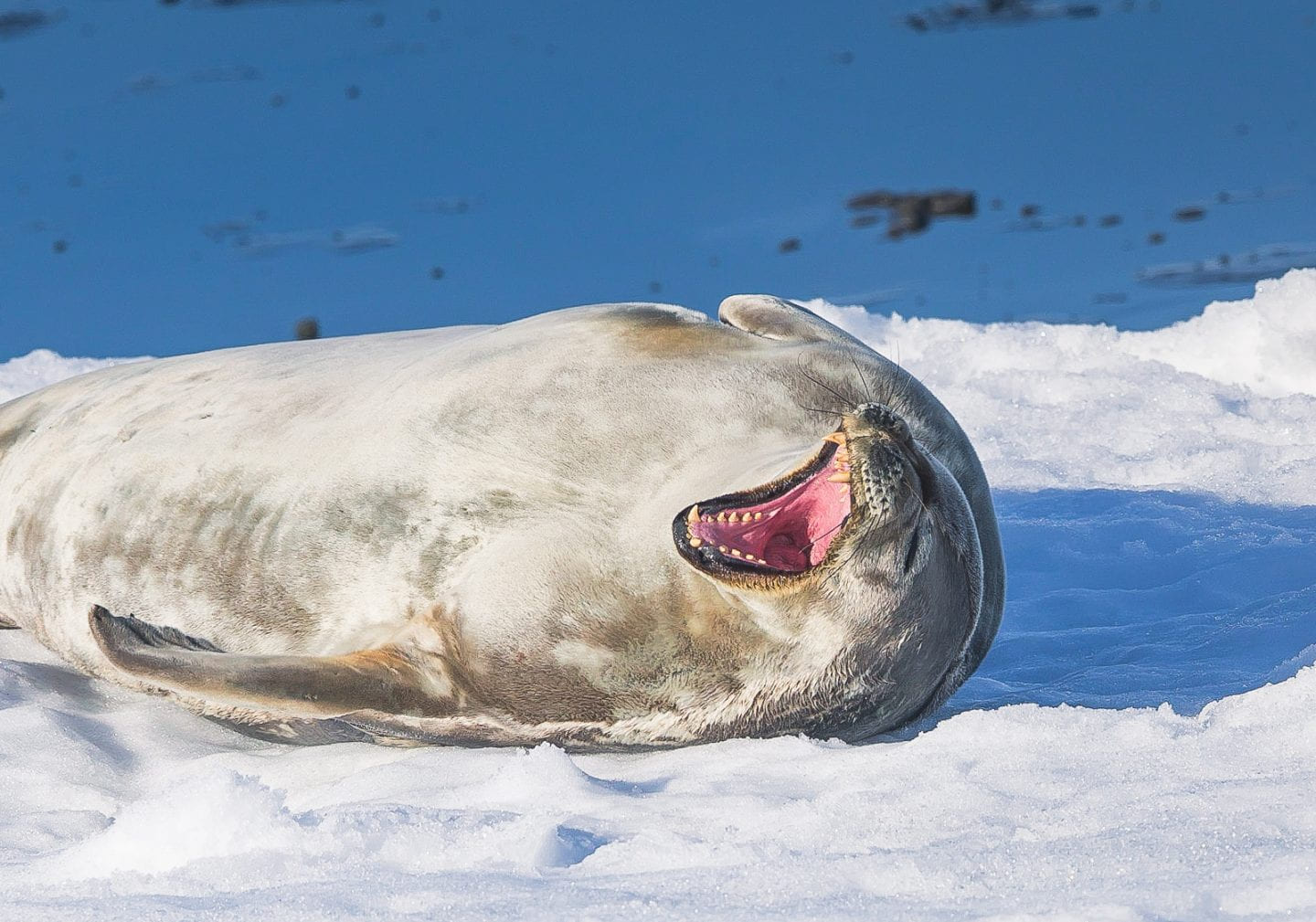
Weddell seal yawning, Damoy Point, Antarctica
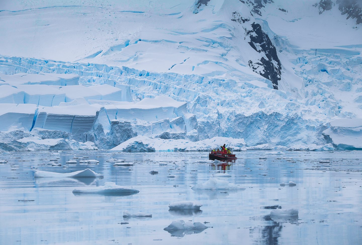
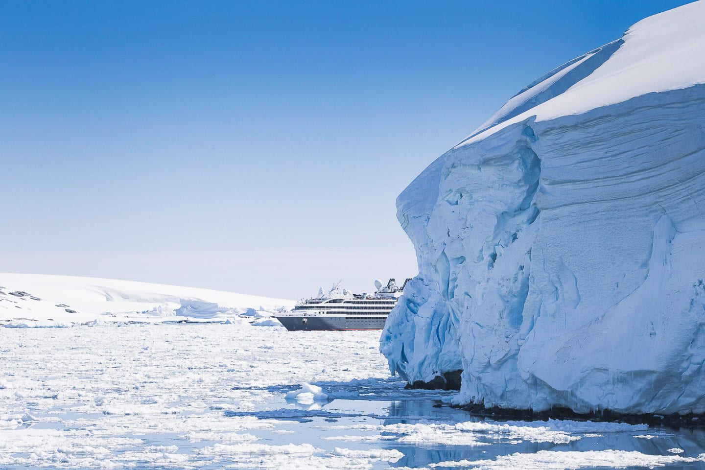
Lemaire Channel
The last day in Antarctica started off with humpback whales and orcas outside our window. Carlos has literally never gotten out of bed and gotten dressed faster, hahaha.
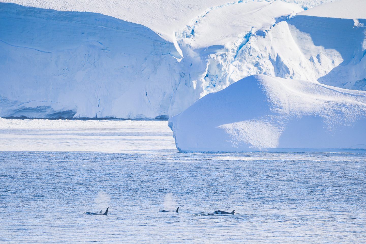
Orcas at the entrance of Lemaire channel, Antarctica
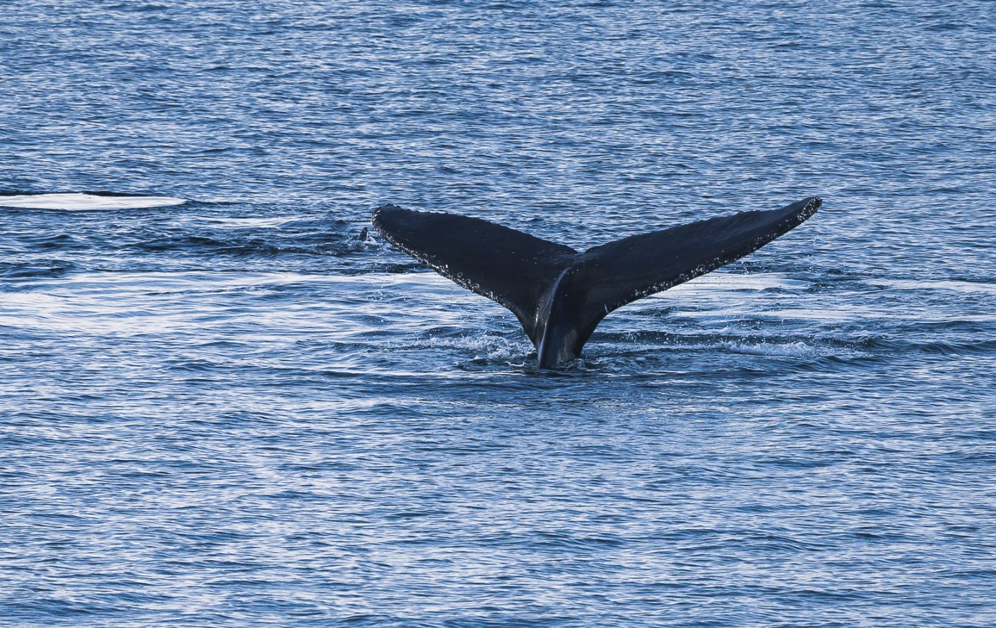
Humpback whale, Lemaire Channel, Antarctica
The last day in Antarctica also took us to the most southern point on the journey... but first we attempted to navigate the Lemaire Channel.
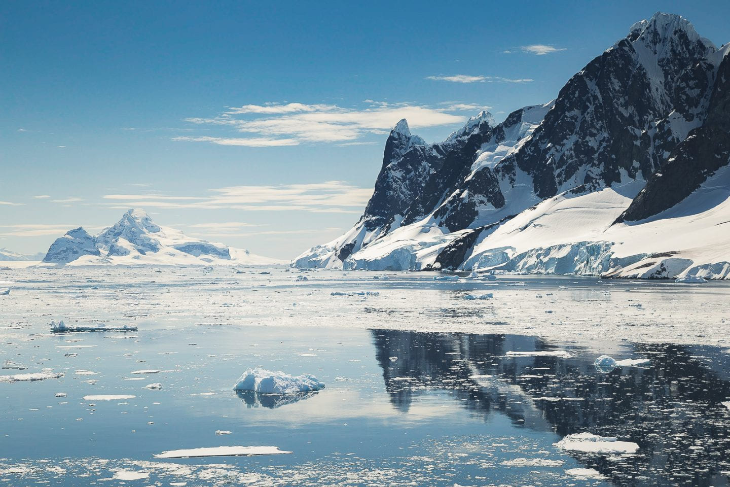
Entering the Lemaire Channel, Antarctica
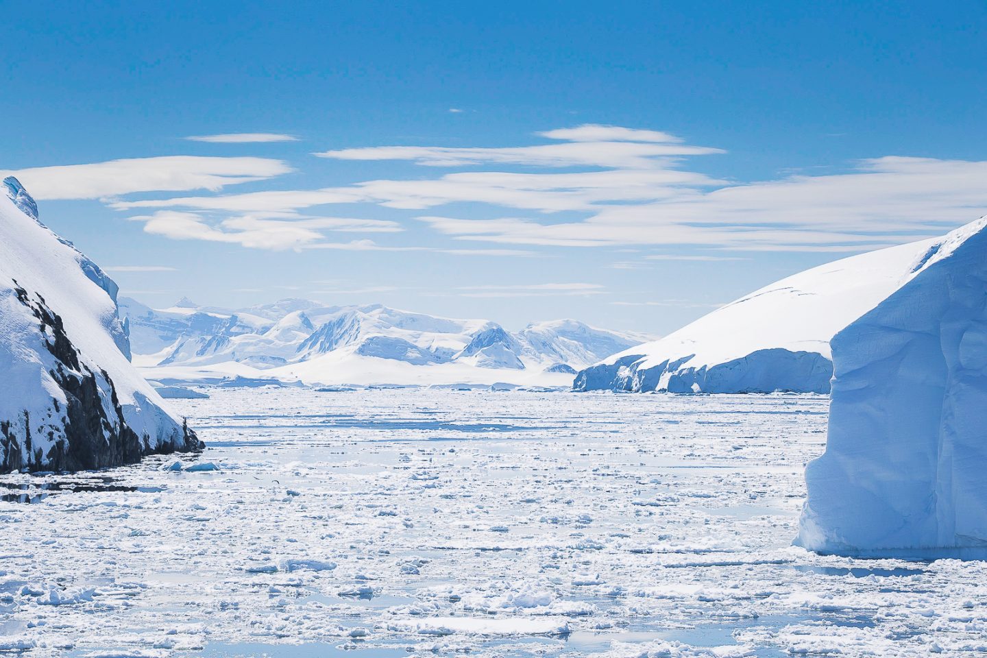
11km long and only 1,600km wide at its narrowest point, the Lemaire Channel is famously popular and rightfully so. It features all the best Antarctic landscape has to offer - steep cliffs, plethora of icebergs, protected still waters, assorted wildlife - all in one and seemingly close enough to touch.
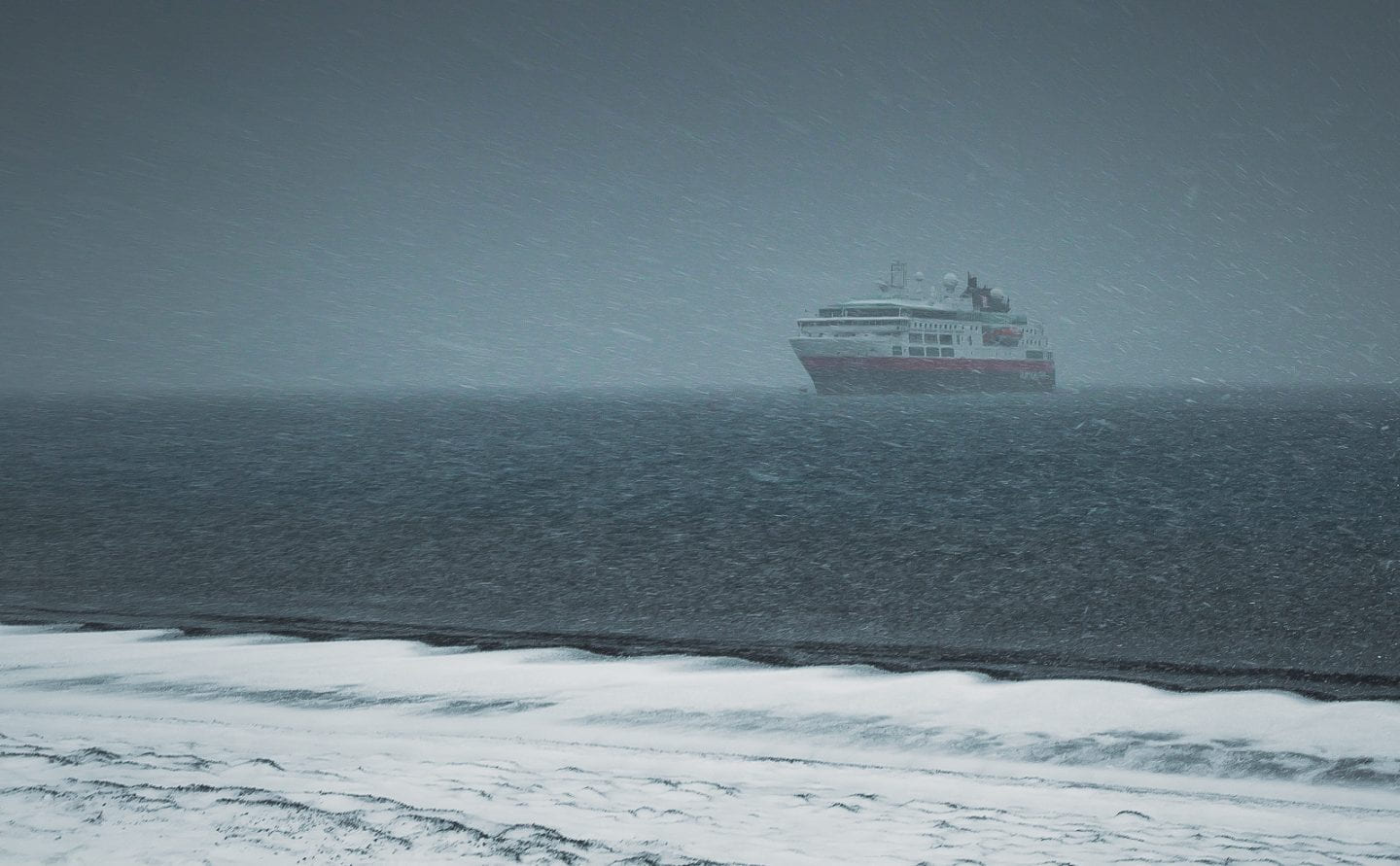
Passing by another ship leaving the channel, Lemaire Channel, Antarctica
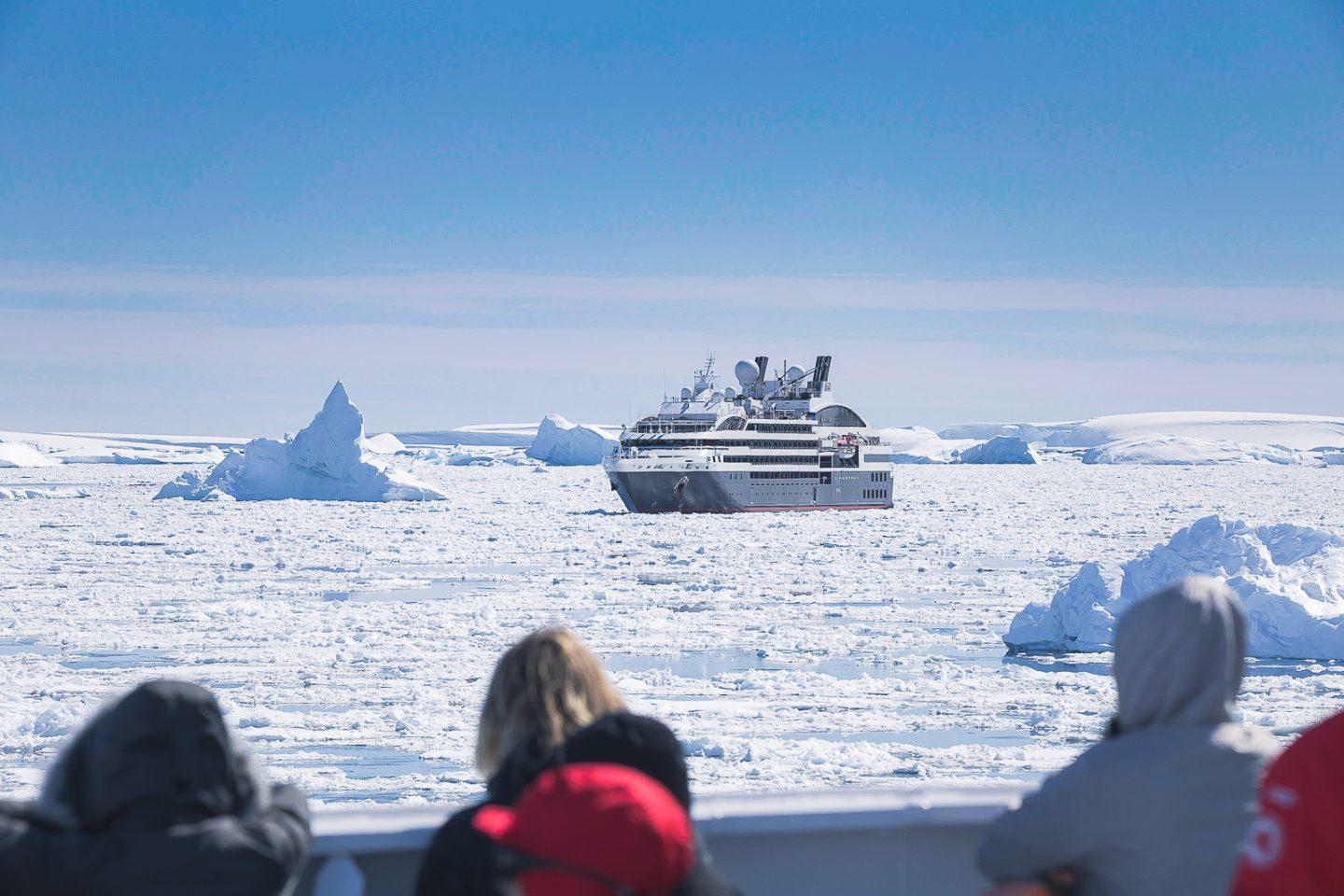
Having gone early in the season, it was possible for the Lemaire Channel to be too filled with ice for the ship to make it all the way through. We all hoped that we would make it. Almost the entire ship was out on deck, taking in the scenery and watching the ship cut a trail through the ice.
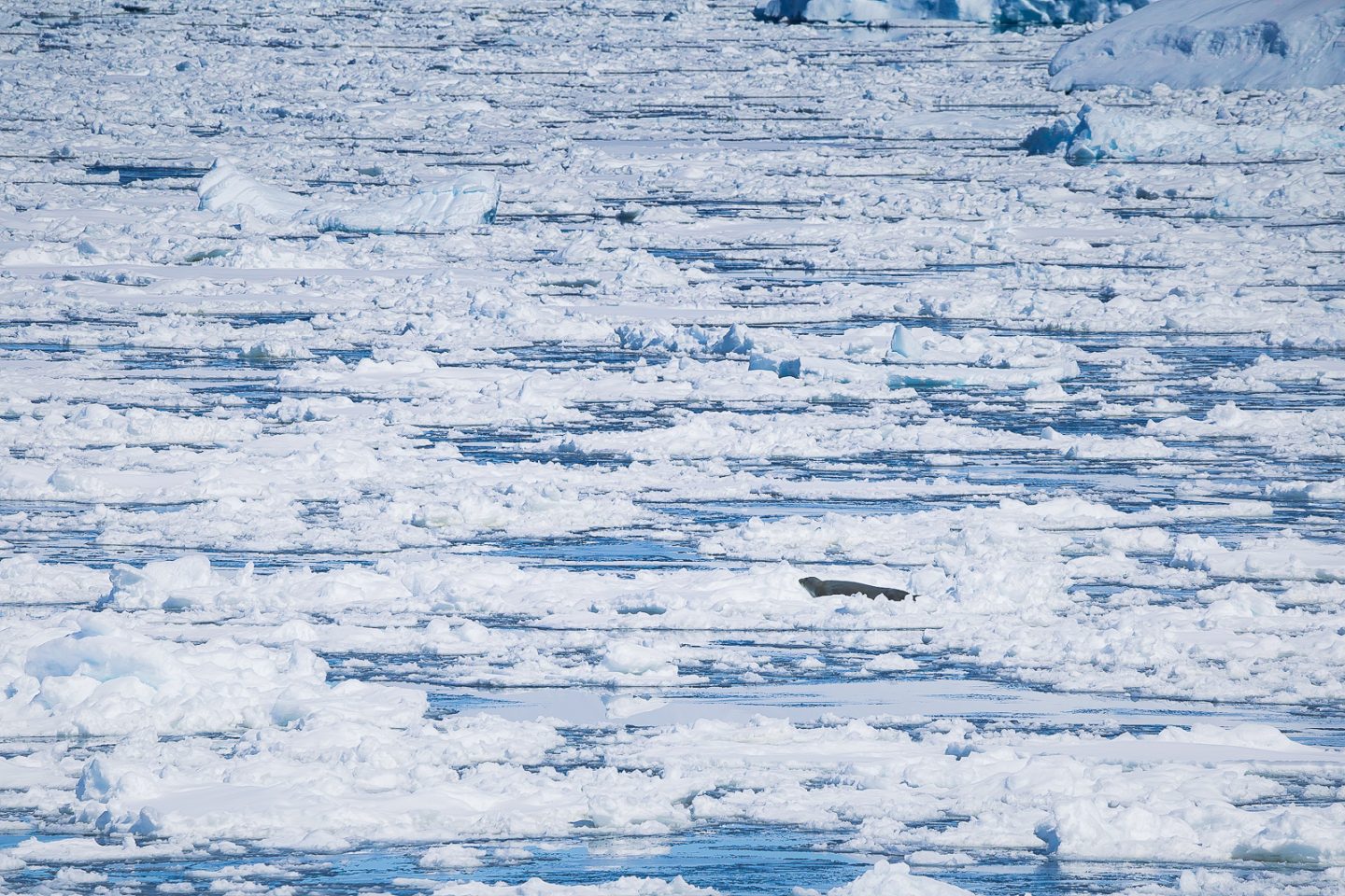
Weddell seal on the ice ahead of us, Lemaire Channel, Antarctica
Sometimes we were so close to the iceberg it felt like we were headed into a collision. The cliffs on either side towered over us like enclosing walls. MS Fram had never felt so small.
Icebergs next to the ship, Lemaire Channel, Antarctica
Groups of penguins swam along beside us, occasionally jumping on and off of low icebergs. Seals lounged around, unperturbed. The icebergs themselves came in all shapes and sizes. It was hard to believe something of that size was floating... and most of its mass was under the surface!
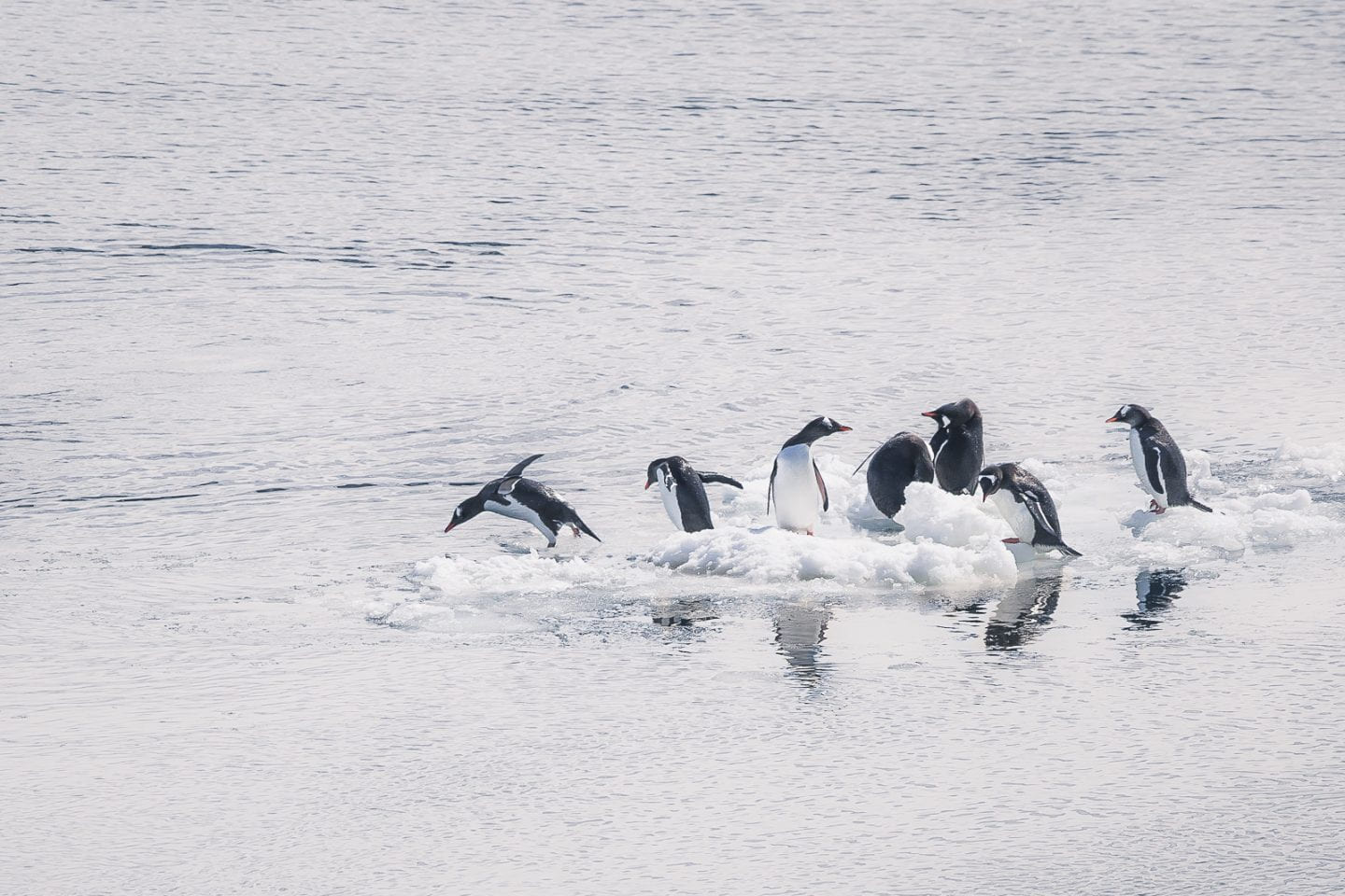
Gentoo penguins on an iceberg, Lemaire Channel, Antarctica
Leopard seal yawning, Lemaire Channel, Antarctica
The captain manually navigated us through the entire channel - bravo! Beyond that, the sea of ice stopped us from going any further. Officially, we made it as far south as 65 degrees South and 64 degrees West, within 1.5 degrees of the Antarctic Circle. Amazing!
View at the southernmost point of our journey, Lemaire Channel, Antarctica
Heading back into Lemaire Channel, Antarctica
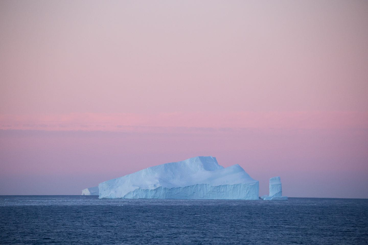
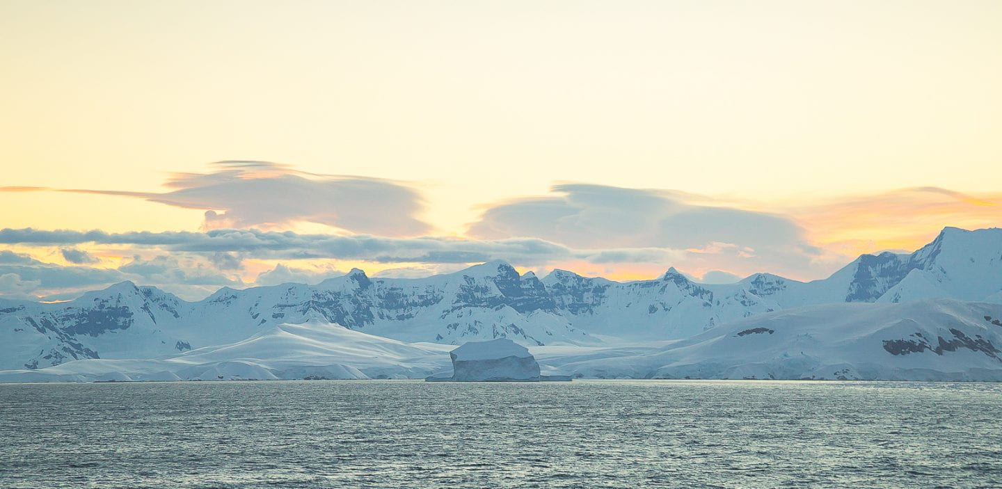
And just like that, the ship turned around, and we started the journey back north. As we left Antarctic waters, the frozen continent bid us farewell with a gorgeous, ice-filled sunset.
Leaving the Lemaire Channel behind, Antarctica
Was this a good or bad omen for the Drake Passage? We could only guess.
Drake Passage
Known to be the roughest seas in the world, the Drake Passage connects three oceans - Pacific, Atlantic, and Southern - thus also acts as the passage between two continents - Antarctica and South America. All of this meant that it was an inescapable way home. The Drake Passage can either be "Drake Lake" (dead calm) or "Drake Shake" (violently rough). Carlos was desperately hoping to "Drake Shake." Julie was desperately hoping for "Drake Lake." What we got was a mix of both... maybe more towards "Drake Lake" in the grand spectrum of how bad the Drake Passage could be.
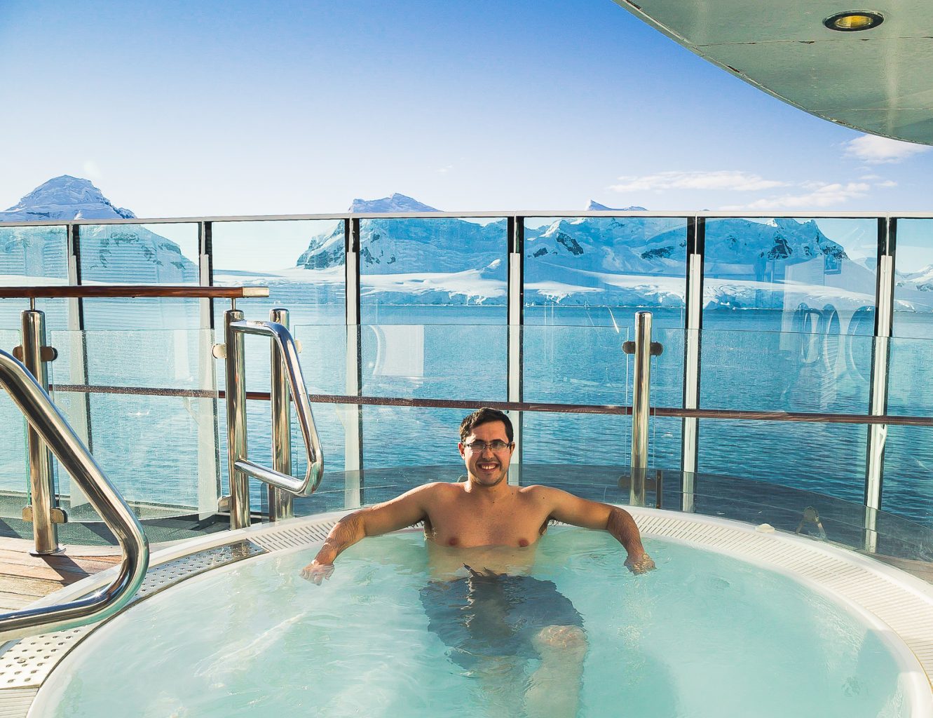
Carlos in the jacuzzi as we enter the Drake Passage, Antarctica
One of the Expedition Team members rated our crossing a 3/10 on a scale of 1 to 10, with 10 being the worst he has ever experienced. That may sound OK, but consider this: wind speed was up to 72 km/h (45 mph), while waves eclipsed 6 meters (20 ft)!!! We don't even want to think about what a 10/10 would be like. Ugh.
Last iceberg of the expedition, Drake Passage, Antarctica
The ship had more movement than we had ever experienced on a cruise - you could lose balance if you weren't careful at times. Reading or looking at screens made us both feel more ill. Even being in our cabin exaggerated the ship's movement. The two days through the Drake Passage passed by in a hazy blur of sitting for hours at a time in the panorama lounge looking out at the horizon and trying our best to keep food down. All in all not terrible, but it made the idea of leaving the expedition to get back on solid land a little less sad.
Leaving Antarctica behind, Drake Passage, Antarctica
Antarctica and this entire 22-day expedition through Falkland Islands and South Georgia was the best travel experience we've ever had. We loved absolutely all of it. Our expectations were insanely high - yet they were completely shattered beyond our wildest dreams. It's going to take some time for it all to sink in... but we would do it again in a heartbeat.
For more pictures from Antarctica, please check out the Antarctica gallery!